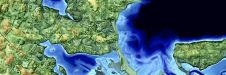
Shallow Water & Coastal Mapping Weeks
26 April to 30 May - Hydro International proudly presents the Shallow Water and Coastal Mapping Weeks, which will immerse you in experiences, tools and advances in mapping shallow water...
26 April to 30 May - Hydro International proudly presents the Shallow Water and Coastal Mapping Weeks, which will immerse you in experiences, tools and advances in mapping shallow water...
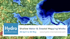
Hydro International proudly presents the Shallow Water & Coastal Mapping Weeks, which will immerse you in experiences, tools and advances in mapping shallow water topography and coastal environments. The generation of...
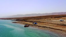
Coastal erosion is reshaping our world, threatening homes, industries and culturally important places. By taking advantage of the unique conditions in the Dead Sea and leveraging modern ADCP technology, scientists...
Fugro has tested a multi-sensor approach to balance growing data needs with limited agency budgets. Coastal mapping programmes are quickly becoming a priority for government agencies across the globe. The desire...
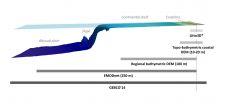
SHOM contributes routinely to the preparedness against coastal risks along French coastlines. For this purpose, regional to coastal digital elevation models are built for implementation in forecast systems against rapid...
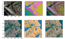
A new paper published in 'Scientific Data' presents the ‘CoastTrain’ dataset, a collection of orthomosaic and satellite images of coastal environments along with corresponding labels. The dataset includes 1.2 billion...
This site uses cookies. By continuing to use this website, you agree to our Cookies Policy. Agree