High-definition Imaging Sonar
US-based Sound Metrics has launched its newest product, the ARIS Explorer line of high-definition imaging sonar. The device offers detailed and video-like resolution. There are three ARIS Explorer models: the...
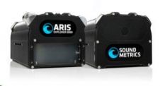
US-based Sound Metrics has launched its newest product, the ARIS Explorer line of high-definition imaging sonar. The device offers detailed and video-like resolution. There are three ARIS Explorer models: the...
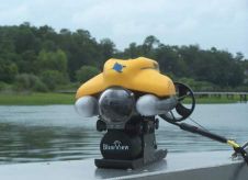
BlueView Technologies has received an order for one hundred (100) high-resolution P Series Imaging Sonar systems. In the coming months BlueView will deliver the compact, low-power 900kHz imaging sonar systems...

In the annals of aviation history, a captivating mystery endures – the perplexing vanishing act of pilot Amelia Earhart. Renowned American explorer Tony Romeo confidently claims to have identified the...

In the quest to unravel the mysteries beneath our planet’s water bodies, topobathymetric technologies emerge as a beacon of innovation. Among them, Lidar (light detection and ranging) and sonar sensors...

Salman Bashit, an urban planning graduate from Khulna University in Bangladesh, is currently furthering his education in Geoscience at Mississippi State University. His academic and professional journey is marked by...
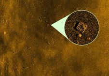
Kongsberg Discovery has unveiled a new analysis tool, developed in collaboration with underwater imaging specialist Cathx Ocean. This innovative tool significantly streamlines the process of detecting and classifying objects of...
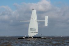
Saildrone announced the launch of its first aluminium Surveyor unmanned surface vehicle (USV) from the Austal USA production line in Mobile, Alabama. Chief of Naval Operations (CNO) Adm. Lisa Franchetti was...

Oceanology International 2024 (Oi24) is set to captivate attendees with a showcase of pioneering companies and innovative technologies, all poised to command attention at London's ExCeL. From advanced autonomous vehicles...

The presence of suspended sediments in water bodies presents significant challenges for the dredging industry. Existing methods to determine nautical depths are intrusive single point methods relying on in situ density or shear strength measurements1,3 or low-frequency single-beam echosounder recordings1,2. The use of single-beam echosounders is however systemically problematic as they are not practical in satisfying the CATZOC A1 coverages required for contemporary electronic navigational charting. The presence of suspended sediments in water bodies presents significant challenges for the dredging industry. Existing methods to determine nautical depths are intrusive single point methods relying on in situ...

Teledyne Odom Hydrographic and Teledyne BlueView will be performing demonstrations onboard the survey vessel Meon Surveyor during all three days of Ocean Business 2013 in Southampton, UK. Teledyne Odom will...
This site uses cookies. By continuing to use this website, you agree to our Cookies Policy. Agree