Very Shallow-water Bathymetry
The River Murray Operations Unit (RMOU) of the South Australian Water Corporation surveys very shallow waters, a type of surveying that has its own specific problems overcome by non-conventional solutions....
The River Murray Operations Unit (RMOU) of the South Australian Water Corporation surveys very shallow waters, a type of surveying that has its own specific problems overcome by non-conventional solutions....
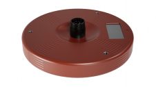
OSIL has recently supplied several SonTek Argonaut-XR (Extended Range) Acoustic Doppler Current Profilers for use in projects where shallow-water current monitoring is required. The Argonaut XR is specifically designed for...
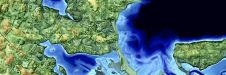
26 April to 30 May - Hydro International proudly presents the Shallow Water and Coastal Mapping Weeks, which will immerse you in experiences, tools and advances in mapping shallow water...
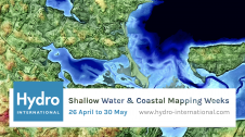
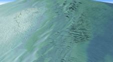
Hydro International proudly presents the Shallow Water & Coastal Mapping Weeks, which will immerse you in experiences, tools and advances in mapping shallow water topography and coastal environments. The generation of...
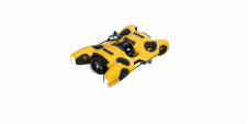
Hydromea, an industry leader in high-speed subsea communications and portable underwater inspection robotics, introduced a groundbreaking product at Oceanology International 2024 in London. The event marked the official commercial launch...

In an era of great power competition, unmanned maritime systems (UMSs) have begun to take centre stage and are now on an accelerated development path for reasons that are clear....
The latest innovation from Exail, a prominent provider of maritime autonomy solutions, is the DriX O-16, a transoceanic uncrewed surface vessel (USV). With an impressive autonomy range of 2,500 nautical...
Kongsberg Discovery, a leading player in oceanographic instrumentation, has introduced a new product innovation to the ADCP market, blending “flexibility, simplicity and high-resolution performance.” Unveiled at Oceanology International, the CP333...
Teledyne Geospatial has announced that Tetra Tech, a leading provider of high-end consulting and engineering services, recently acquired a Teledyne Optech CZMIL SuperNova Topobathymetric Lidar system. Tetra Tech has successfully...
Canada is the second largest country in the world, with a shoreline measuring approximately 243,800km, more than six times the circumference of the Earth. The Canadian Hydrographic Service (CHS), established...
This site uses cookies. By continuing to use this website, you agree to our Cookies Policy. Agree