Object Recognition Enables Smart Robotic Behaviour
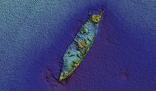
For many applications, we need to know what is where underwater. Side-scan sonar is one of the core sensors for imaging the bed of water bodies and it is increasingly...
For many applications, we need to know what is where underwater. Side-scan sonar is one of the core sensors for imaging the bed of water bodies and it is increasingly...
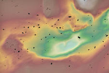
Ongoing collaboration between INFOMAR and the National Monuments Service continues to produce exciting results on Ireland’s underwater cultural heritage. Last autumn, the Geological Survey Ireland’s RV Keary resurveyed the 1797...
Archaeologists have long been interested in shipwrecks. These sites can tell us about ancient transportation and trading routes, technological innovations and cultural exchanges over thousands of years. Documenting shipwrecks can...
In the night of 14 April 1912, the unthinkable happened. The mightiest ship afloat, the brand new White Star Line ship Titanic, was on its maiden voyage from Southampton, England,...
Bo Krogh, senior surveyor, has more than 35 years’ experience in hydrographic, engineering, environmental and archaeological survey projects, including offshore construction surveys, seabed mapping surveys, marine archaeology surveys with AUVs,...

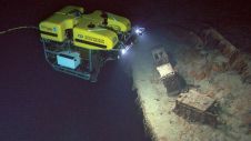
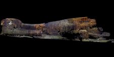
A First World War German submarine has been surveyed for the first time since its loss in 1917. Sophisticated scanning techniques and deep-sea video footage have revealed a large hole...
After 75 years, and using advanced imaging technology, ocean explorer Tim Taylor and his Lost 52 expedition team have officially discovered the final resting place of the 49 sailors of the...

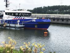
Fugro’s multipurpose vessel Fugro Pioneer left the Port of Sunderland in the UK earlier this month to kick off a six-month offshore site investigation and survey campaign for innogy’s Sofia...

Researchers from Mexico’s National Institute of Anthropology and History and Spain’s National Museum of Underwater Archaeology will try to find the wreckage of a Spanish galleon which went down carrying...
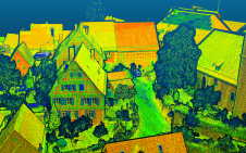
Lidar mapping based on unmanned aerial vehicles (UAVs or ‘drones’) can generally be thought of as a close-range version of manned airborne laser scanning. In brief, lower mobilization costs and...
This site uses cookies. By continuing to use this website, you agree to our Cookies Policy. Agree