Steering shipping towards a sustainable future
Ocean data has a vital but underappreciated role to play as an enabler in shipping’s energy transition. In particular, it can help to unlock the short-term carbon savings that will...

Ocean data has a vital but underappreciated role to play as an enabler in shipping’s energy transition. In particular, it can help to unlock the short-term carbon savings that will...
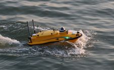
CHC Navigation (CHCNAV), a leading manufacturer of uncrewed surface vehicle (USV) technology, has introduced the Apache 3 Pro – an advanced compact hydrographic drone engineered for autonomous bathymetric surveys in...
Teledyne Optech and Teledyne CARIS have united to form Teledyne Geospatial in response to evolving marketplace needs. Under the Teledyne Imaging group, the harmony between the two business units is...
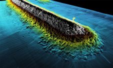
Fugro recently introduced its next-generation coastal mapping system, the Rapid Airborne Multibeam Mapping System (RAMMS 2.0), at the Hydro 2023 conference in Genoa, Italy. RAMMS 2.0, the world’s only airborne...
Teledyne has announced the launch of a geospatial group with the unification of its Optech and CARIS businesses. The new Teledyne Geospatial group will offer holistic solutions to seamlessly map...
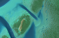
A decade after completing its first shoreline mapping project, NV5 Geospatial has mapped over 10.5 million hectares of North America’s shoreline and riverine environments for more than 200 projects. These...
GCS, based in the USA, has opened additional online seating for its first Geospatial Big Data webinar. The webinar will focus on “Building, Deploying and Managing Applications in the Cloud”...
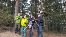
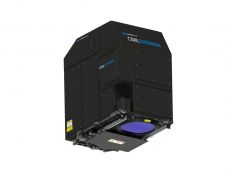
The Finnish Geospatial Research Institute (FGI) has recently added the RIEGL VQ-840-G airborne laser scanner to its impressive collection of sensors. FGI innovators are true scientists, moving the 3D industry...
This site uses cookies. By continuing to use this website, you agree to our Cookies Policy. Agree