Common Geospatial Tool Set Programme for MoD
Geospatial consultancy Helyx, UK, has delivered on key objectives in the operational application of the Common Geospatial Tool Set (CGTS) programme being undertaken by Team SPARTA for the UK Ministry...
Geospatial consultancy Helyx, UK, has delivered on key objectives in the operational application of the Common Geospatial Tool Set (CGTS) programme being undertaken by Team SPARTA for the UK Ministry...
The fourth annual Rocket City Geospatial Conference (RCG) offers special sessions this year on key issues impacting the Southeastern United States. The conference will feature a special session on the...
Spatial Energy have entered into a new strategic partnership agreement with TCarta Marine LLC to exclusively offer TCarta Marine digital geospatial data and advanced GIS services globally to the energy...
Hydrographic data are usually characterised by their geospatial nature, with tremendous and huge amounts of information that are usually abundant but are not adequately maintained, managed and represented for effective...
Marport C-Tech has signed a teaming agreement with OSI Geospatial to integrate Marport's CSDS-85 Underwater Intruder Detection Sonar with the OSI Geospatial Asset Control and Tracking (ACT) system. ...
1Spatial, through its subsidiary ComSine, has delivered to Pole Star Space Applications Limited (UK) an advanced geospatial analysis subsystem to form part of its MarVTS LRIT-DC product and in addition...
The TrueOcean Marine Data Platform (MDP) has recently seen the addition of a new geospatial search function that enables data on the platform to be located and accessed in seconds...

The ocean plays a crucial role in mitigating climate change, yet we lack detailed information on over 95% of the seafloor. This article explores planblue’s solution to accelerate time-to-data and...

In 2017, OceanWise outlined the work of the UN-GGIM. The Committee of Experts endorsed the terms of reference for establishing a Working Group on Marine Geospatial Information. Here, Dr Mike Osborne and John Pepper provide a timely update on what has been happening since then. In 2017, OceanWise outlined the work of the UN-GGIM. The Committee of Experts endorsed the terms of reference for establishing a Working Group on Marine Geospatial Information. Here, Dr Mike...
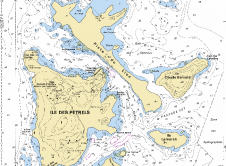
East View Geospatial (EVG) has reached an agreement with the French Naval Hydrographic and Oceanographic Service (Service Hydrographique et Océanographique De La Marine, SHOM) to offer digital nautical charts of...
This site uses cookies. By continuing to use this website, you agree to our Cookies Policy. Agree