Effective Surveying Tool for Shallow-water Zones
A recent article provides an overview of satellite-derived bathymetry methods and how data can be integrated into survey campaigns, and showcases three use cases. Bathymetric data...
Every month we will focus on a specific theme, featuring a selection of articles which have previously been published in Hydro International magazine. By including a mix of older and more recent articles, we will present a complete recap of the subject. Furthermore, we will be bringing you a bi-weekly round-up of ‘Focus Stories’ related to the theme through our newsletter (sign up here). The theme for September 2017 is:
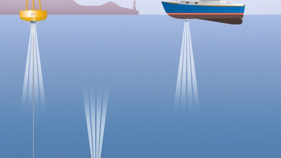
Even when for inland water mapping the hydrographic techniques are familar, there are special requirements and challenges often due to the specific characteristics of inland survey and positioning. Often it's related to the reduced depth, accessibility or working space. This also creates opportunities to use techniques like airborne Lidar bathymetry or USVs.
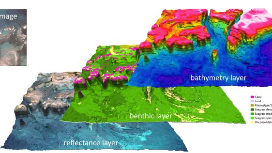
A recent article provides an overview of satellite-derived bathymetry methods and how data can be integrated into survey campaigns, and showcases three use cases. Bathymetric data...
Hydrographic surveying in ultra-shallow, inland and enclosed waters can prove extremely challenging and often presents increased risks and obstacles to both personnel and equipment...
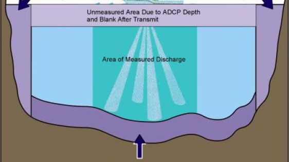
Rather than a spinning propeller, the Acoustic Doppler Current Profiler (ADCP) – just like dolphins and bats – uses sound to explore its environment. Operating underwat...
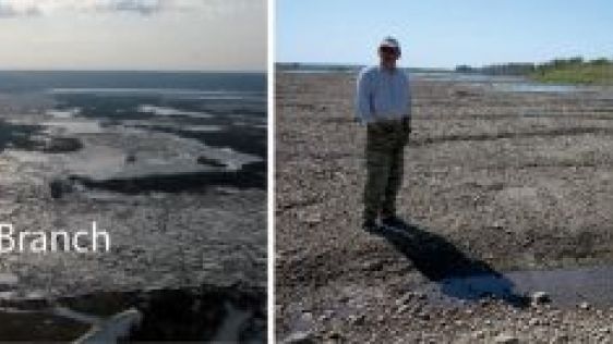
The large, poleward flowing rivers of Siberia, such as the Ob River, experience persistent and severe floods when river ice breaks up in the spring. Ice-jams are common on the Tom...
Every month we will focus on a specific theme, featuring a selection of articles which have previously been published in Hydro International magazine. to present a complete recap of the subject. If you don't want to miss these themed recaps, sign up for the newsletter (sign up here).
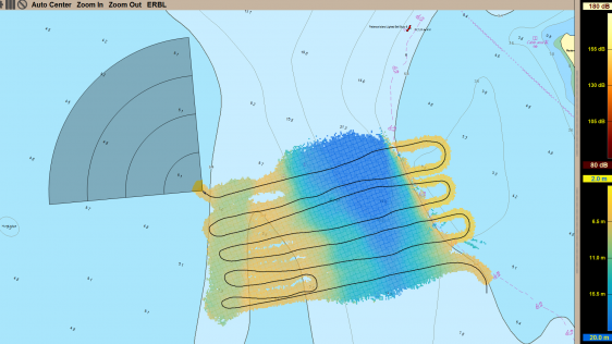
There is a key new feature in the discharge measurement software ViSea DAS that allows the user to add a bottom profile. By doing so, side extrapolation from the start and end poin...

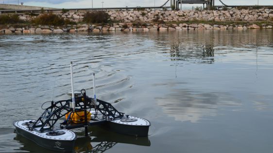
The hydrographic survey industry is changing and moving away from manned operations in an effort to reduce costs and increase safety. During the Shallow Water Survey 2015 conferenc...
Seaports, waterways and climate are inextricably linked. Weather anomalies change bottom contours and destroy aids to navigation, compromising safety. In the past decade, maritime...
In order to meet the requirements of the European Water Framework Directive (EU-WFD), authorities face the problem of performing area-wide surveys of all kinds of inland waters rep...

Numerical models are used to predict water levels, wave heights and wind fields under extreme storm conditions. This paper aims to give a short overview of the measurements of thre...
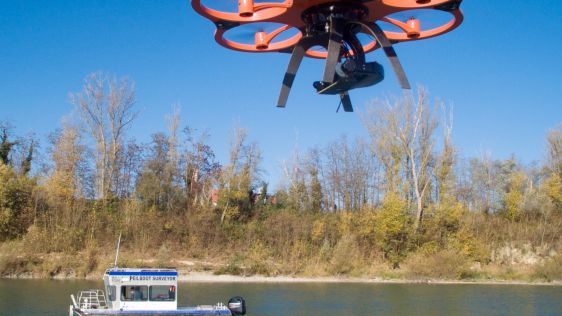
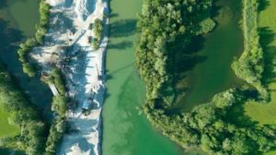
Knowing the volume of material present in a gravel quarry can make the difference between profit and loss. A gravel quarry in Hartheim am Rhein, southwest Germany, is partially cov...

The Port of London Authority (PLA) has had an extensive tide gauge network for many years. However, the existing system, installed in the 1990s was becoming increasingly unreliable...

A major part of Paraguay River’s sounding and signalling is maintained by the Brazilian Navy. Trying to stay abreast of the state of the art on inland hydrography and cartogr...

With over 500 line connections to and from more than 1,000 ports around the globe, the Port of Rotterdam in The Netherlands is the cornerstone of international freight transport.&n...

The 2nd Fluvial Hydrography Workshop, organised and hosted by the Peru Hydrographic Service for Navigation of the Amazon (SHNA), was held in Iquitos, Peru, from 12 to 13 November 2...
Follow Hydro International on Facebook, LinkedIn, Twitter or sign up for the newsletter! Don't miss the latest developments: join Hydro International!
 |  |  |  |
| 14.540 SUBSCRIBERS | 7.245 MEMBERS | 5.205 LIKES | 4.632 |
This site uses cookies. By continuing to use this website, you agree to our Cookies Policy. Agree