Next-generation Surveyors Using Next-generation Technology
Twenty 3rd-year students of ocean technology from the Maritime Institute Willem Barentsz (MIWB, The Netherlands) participated in the 4th edition of the Lake Survey. Building on las...
This product group appears to be wide and often underestimated – considered as a tool. The hydrographic processing software packages are developing and they deserve the attention as they help the hydrographic surveyor to get most out of his data.
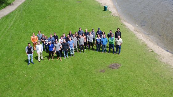
Twenty 3rd-year students of ocean technology from the Maritime Institute Willem Barentsz (MIWB, The Netherlands) participated in the 4th edition of the Lake Survey. Building on las...
In March 2015, Leica Geosystems conducted a series of demonstration surveys in Japan with the HawkEye III Airborne Topographic Bathymetric Lidar system. This demonstration was...
Every month we will focus on a specific theme, featuring a selection of articles which have previously been published in Hydro International magazine. to present a complete recap of the subject. If you don't want to miss these themed recaps, sign up for the newsletter (sign up here).
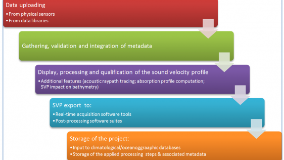
Hydrographic and geosciences surveys, using acoustic devices, need to use accurate water sound velocity profiles. Because the acoustic path depends on the sound velocity profile (S...
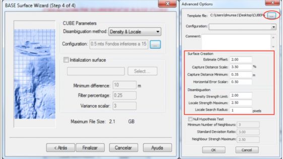
Interferometric sonars acquire millions of soundings in a hydrographic survey. The processing of this data by a hydrographer without a reliable statistical algorithm like CUBE (Com...

By the end of this year, the gap will have finally closed on the mandatory requirements for ships to carry an Electronic Chart Display and Information System (ECDIS), with all exis...
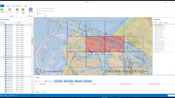
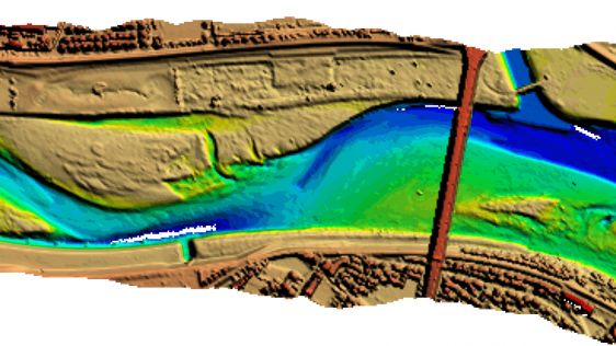
The Port of Rotterdam is a leading global port and by far the largest seaport in Europe. The port is situated in the Rhine delta and with its direct connection to Europe’s la...
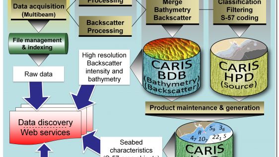
The Canadian Hydrographic Service (CHS) is willing to make better use of the backscatter intensity data collected with their multibeam sounding systems. All the backscatter data co...
Side-scan sonar is well accepted as a tool for detection and visualisation of underwater objects and is widely used in support of safety of navigation surveys. Although side-scan s...
Follow Hydro International on Facebook, LinkedIn, Twitter or sign up for the newsletter! Don't miss the latest developments: join Hydro International!
 |  |  |  |
| 14.540 SUBSCRIBERS | 7.245 MEMBERS | 5.205 LIKES | 4.632 |
This site uses cookies. By continuing to use this website, you agree to our Cookies Policy. Agree