Hidden landscapes: the mapping of Ireland’s shelf geomorphology
The Marine Geoscience Research Group at University College Cork, under the aegis of the Irish Marine Institute, has published the first high-resolution geomorphological map of most...
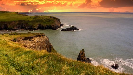
The Marine Geoscience Research Group at University College Cork, under the aegis of the Irish Marine Institute, has published the first high-resolution geomorphological map of most...
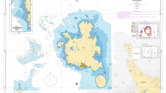
Given the Netherlands’ geographical location, it is unsurprising to find it has a long tradition of hydrography. The lowland, often below sea level, forms a delta where major...
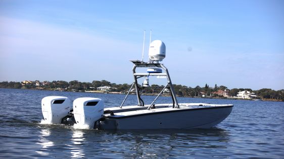
In an era of great power competition, unmanned maritime systems (UMSs) have begun to take centre stage and are now on an accelerated development path for reasons that are clear. Li...
In the quest to unravel the mysteries beneath our planet’s water bodies, topobathymetric technologies emerge as a beacon of innovation. Among them, Lidar (light detection and...
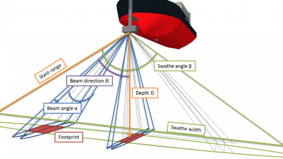
Although the single beam echosounder is still in use, it has over the last 25 years gradually been replaced with new and less expensive multibeam echosounder (MBES) systems. And, a...
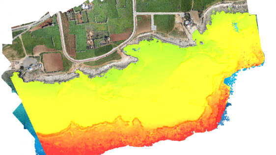
Accurate bathymetric mapping of shallow areas is essential for many offshore activities. Through Structure from Motion (SfM) and Multiview Stereo (MVS) techniques, images can...

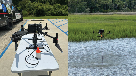
How can AUVs be reliably used to map the 3D structure of the underside of sea ice, especially now that the climate crisis makes it more important than ever to understand its comple...

Currently, calibration of multibeam echosounders (MBES) for hydrographic surveys is based on the traditional ‘patch test’ method. This subjective method, although rigor...
It is widely and wrongly assumed that the world’s coastal regions have been surveyed in detail by modern techniques and that the resulting nautical charts are an accurate ref...

With millions of people around the world at risk from rising seas, it is essential to continue measuring the changing height of the sea surface to ensure that decision makers are e...

After 75 years, and using advanced imaging technology, ocean explorer Tim Taylor and his Lost 52 expedition team have officially discovered the final resting place of the 49 s...

What is the best image classification technique to optimize maps so that effective action can be taken to conserve seagrass meadows? The distribution of Posidonia oceanica seagrass...

On 20 September 2019, the German research icebreaker Polarstern left Tromsø, Norway, for what could be the biggest Arctic research expedition of all time. Once she reac...

Munitions in the sea pose a risk to the sustainable development of the ocean economy. In particular, they are a global challenge during the construction of wind farms, pipelines an...
Submarine groundwater discharge (SGD) is a significant part of the water cycle that delivers anthropogenically derived and naturally occurring nutrients to coastal waters. As part...

Inspection of dams is a high-risk task for divers because of strong currents and eddies. The use of emerging technologies such as uncrewed surface vehicles equipped with echos...

The AUV has been the tool of choice for shallow-water MCM and EOD operations for a number of years. The coverage by popular news channels of unfortunate events, such as the MH370 t...

NOAA is using a systematic approach to map all US waters in support of Seabed 2030 objectives and to contribute to the complete mapping of the world’s oceans in the next ten...

Located in the Atlantic sector of the Southern Ocean, the Weddell Sea generates extremely dense bottom water that spreads into all the world’s ocean basins, transporting oxyg...

Newly developed 3D imaging technology has allowed scientists to map Darwin Mounds, a unique area of cold-water coral reefs off the coast of Scotland, to see whether it ha...

On 12 March, the Dutch government decided to ‘lock down’ all activities involving multiple persons, including education. That decision immediately affected the hydrogra...

As readers of Hydro International know, the world’s ports and harbours are crucial to global trade. From Singapore to Antwerp, and from Shanghai to Rotterdam, Los Angeles, ot...

Recently, the European Marine Board published a report on the current status of the European fleet of research vessels. This position paper describes how the fleet will need to dev...

An estimated 600,000 tons of abandoned fishing gear ends up in the oceans every year. According to the United Nations, some 380,000 marine mammals are killed each year, either by i...

This site uses cookies. By continuing to use this website, you agree to our Cookies Policy. Agree