Mapping northern Greenland waters
An understanding of the interplay between glaciers and the ocean is needed to improve sea-level rise projections. Seafloor mapping is critical in this pursuit, particularly where the ice sheets of...
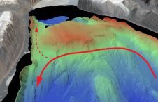
An understanding of the interplay between glaciers and the ocean is needed to improve sea-level rise projections. Seafloor mapping is critical in this pursuit, particularly where the ice sheets of...
The esteemed Finnish Geospatial Research Institute (FGI) is set to utilize advanced Lidar systems developed by the Fraunhofer Institute for Physical Measurement Techniques IPM for future maritime surface surveys. Anticipating...
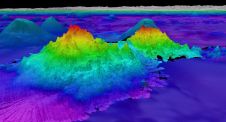
The crew of Schmidt Ocean Institute’s research vessel Falkor (too) recently discovered four underwater mountains – the tallest of which exceeds 2.4km in height – during a January transit from...
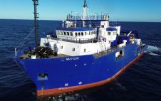
TDI-Brooks has strengthened its fleet with the RV Nautilus, a 75-metre DP2 vessel with enhanced capabilities that was built in 2000. This addition, which features the Geomil Manta-200 CPT system...
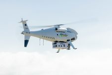
Fugro recently introduced its next-generation coastal mapping system, the Rapid Airborne Multibeam Mapping System (RAMMS 2.0), at the Hydro 2023 conference in Genoa, Italy. RAMMS 2.0, the world’s only airborne...
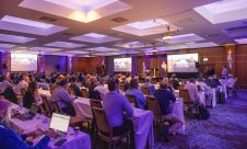
After a long break due to the COVID-19 pandemic, Kongsberg recently organized its 17th Forum for the Exchange of Mutual Multibeam Experiences (FEMME) in Edinburgh, UK. The FEMME conference brought...
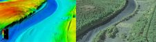
The US Geological Survey (USGS) and Dewberry have jointly released a new topobathymetric Lidar dataset for the Potomac River, extending from the Potomac Highlands in West Virginia to the Chesapeake...
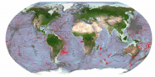
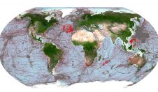
FarSounder is partnering with The Nippon Foundation-GEBCO Seabed 2030 Project to work together to advance the collective understanding of the ocean floor in pursuit of the complete map of the...
Delving into the mysteries of the planet’s final frontier – the ocean – has long captivated human curiosity, with the origins of ocean exploration dating back to 5,000 BC. But...

The 2023 GEBCO Week, taking place on 7–8 November, will bring together ocean explorers, mapping experts and stakeholders from all over the world to discuss progress in ocean exploration, new...
This site uses cookies. By continuing to use this website, you agree to our Cookies Policy. Agree