FGI harnesses Fraunhofer’s Lidar tech for maritime surveys
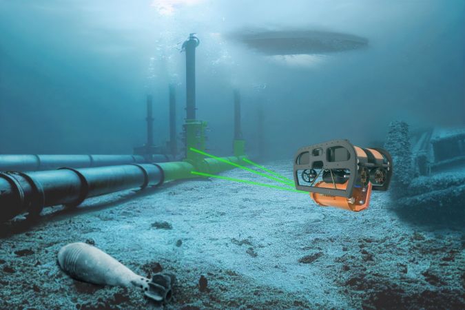
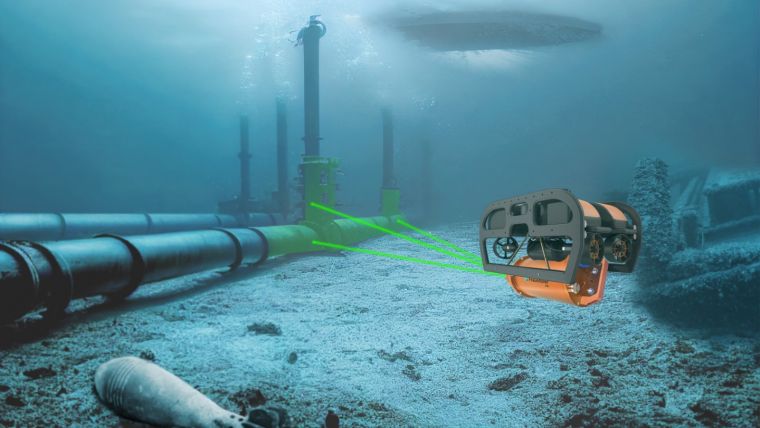
The esteemed Finnish Geospatial Research Institute (FGI) is set to utilize advanced Lidar systems developed by the Fraunhofer Institute for Physical Measurement Techniques IPM for future maritime surface surveys. Anticipating a significant advancement in data quality and field measurement efficiency, the state-run research unit is collaborating with Fraunhofer IPM on a joint project. Together, they aim to create a compact sensor platform for laser-based inspections of critical underwater infrastructures such as offshore wind turbines.
Lidar systems excel in measuring over long distances and provide precise 3D data. While laser-based systems are commonplace for geodetic measurements on land, underwater mapping and topographic measurements have traditionally relied on cameras and sonar due to light attenuation and turbidity underwater. However, Fraunhofer IPM’s introduction of two Lidar systems capable of underwater 3D measurements and aerial bathymetric measurements marks a significant advancement in the field.
3D measurements with millimetre precision
The underwater Lidar system ULi maps infrastructure underwater with millimetre precision using the pulsed time-of-flight method. The system scans statically or when in motion onboard an underwater vehicle or boat. Encased in a pressure-resistant housing, ULi can dive to depths of several hundred metres and measure objects across distances of several tens of metres. The system takes up to ten times more precise measurements than some sonar systems and generates an accurate 3D model of the object.
With the airborne bathymetric laser scanner ABS, Fraunhofer IPM introduces the first laser-based system capable of surveying the topography of coastal areas from the air. The system, which weighs around three kilograms and is the size of a shoe box, has two lasers with different wavelengths (multiwavelength measurement). While conventional laser bathymetry systems are too large and too heavy for standard drones, the ABS is so light it does not require a flight permit. The system is capable of taking measurements at up to twice the Secchi depth with a precision of just a few millimetres.
Both the ULi and ABS systems use full waveform analysis to examine measurement data. This type of signal processing makes it possible to separate the echo sequence conditioned by the water’s surface, the water’s floor and suspended particles, and to extract high-resolution topographical data.
In the future, the FGI will use a combination of both systems. “These two systems combined provide us with a novel and powerful tool to map coastlines and survey objects in 3D at great depths,” enthuses Professor Juha Hyyppä, director of remote sensing and photogrammetry at the FGI. “We will see an unprecedented level of data quality.”
The CoLiBri (Collaborative Lidar to Monitor Infrastructure in the Water and at the Shoreline) research project, funded by the Fraunhofer Society, is a collaboration between FGI, Fraunhofer IPM and the Sustainability Center Freiburg (LZN). The project aims to develop an integrated monitoring process for underwater infrastructure and coastal areas, promote the collaborative use of the systems and evaluate their potential for various applications.