A-SeNS enables Port-Log Data to be Captured by Satellites
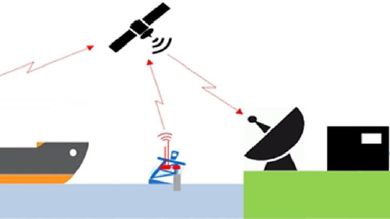
Funded by the European Space Agency (ESA), the A-SeNS project aims to demonstrate the capture of environmental data by satellite. The project extends UK-established OceanWise’s environmental data sharing and publishing capability by enabling data captured by monitoring stations and managed in Port-Log to be transmitted via an AIS transceiver. The satellites are operated by exactEarth Europe, which is also leading the project.
The project involves adding new software code to OceanWise’s Smart Telemetry Unit, thus saving space and power in a fully integrated system. The code packages the data according the International Maritime Organisation’s (IMO) TideMet specification and allows the data to be received locally by vessels as well as by the exactEarth satellites. The data can then be shared more widely for navigation, survey and other maritime operations.
The Automatic Identification System (AIS) is a tracking system used by ships and vessel traffic services for identifying and locating vessels by electronically exchanging data with other nearby vessels, shore stations and satellites. As well as providing information such as vessel location, speed and direction, AIS is capable of handling environmental data, such as wind speed, direction and tide height from weather stations and tide gauges, and water depth from vessel echo sounders.

Value staying current with hydrography?
Stay on the map with our expertly curated newsletters.
We provide educational insights, industry updates, and inspiring stories from the world of hydrography to help you learn, grow, and navigate your field with confidence. Don't miss out - subscribe today and ensure you're always informed, educated, and inspired by the latest in hydrographic technology and research.
Choose your newsletter(s)


