Full ENC Coverage of French Mediterranean Coast
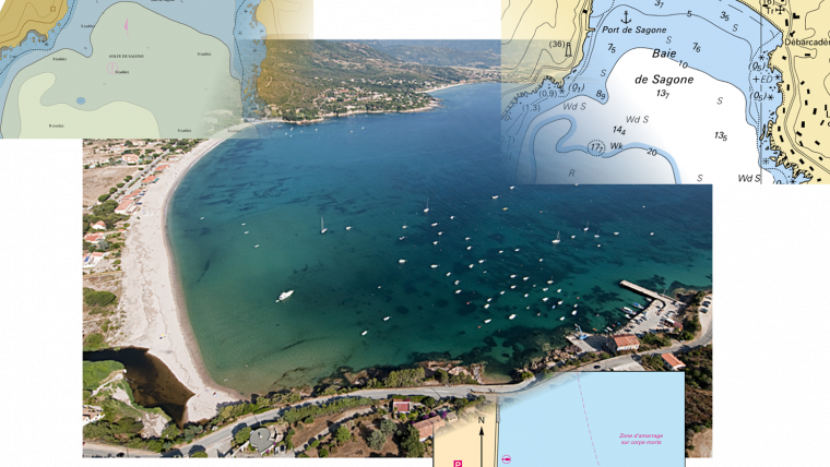
The publication of the electronic navigational chart (ENC) covering the gulf of Sagone in Corsica completes the ENC coverage of French Mediterranean coast. To satisfy the main needs of nautical navigation, around 240 ENCs cover the French coast, and the SHOM goal is to complete this area at the end of 2016, to have the same coverage with paper chats and ENC.
Used with navigational systems, these state official nautical charts improve the safety at sea, and make easier navigation (simultaneous visualization of GPS position, radar data and nautical chart, automatic chart updates…). These nautical charts are the only ones to be used and internationaly recognised under the SOLAS convention.
The French ENC, maintained by SHOM, are available through the ENC distributors network of PRIMAR for vessels subject to the IMO SOLAS convention. For other purposes, these data, limited on French production areas, are available directly through the SHOM website. In the two cases, ENC and data are sold with a subscription for access to updated products for a period.

Value staying current with hydrography?
Stay on the map with our expertly curated newsletters.
We provide educational insights, industry updates, and inspiring stories from the world of hydrography to help you learn, grow, and navigate your field with confidence. Don't miss out - subscribe today and ensure you're always informed, educated, and inspired by the latest in hydrographic technology and research.
Choose your newsletter(s)


