Towards a positive future for Kiribati
Kiribati Outer Islands Transport Infrastructure Investment Project
In an era of environmental challenges and economic uncertainties, nations are earnestly seeking innovative ways to stimulate economic development, improve public safety and enhance the quality of life for their citizens. Kiribati, a small island nation in the Central Pacific, is a leading example of how targeted investments in maritime infrastructure can yield significant benefits.
The Republic of Kiribati is one of the most logistically remote nations in the world, comprising 33 atolls and coral islands spread over 3,441,810km2 of ocean. Interestingly, Kiribati is the only nation that straddles both the equator and the 180th meridian. Kiribati’s approximately 119,000 citizens inhabit only 12 of these islands, with over half of the population on the main island of Tarawa. Incredibly, Kiribati’s total land area is only 811km2 with a maximum elevation of 81m; however, most of the islands are only around two metres above sea level. This means that the Republic and its people are highly susceptible to the impacts of climate change and, notably, sea-level rise.
The remoteness of Kiribati means that many of the uninhabited Outer Islands are virtually untouched by human intervention, with pristine reefs and oceans. However, the downside of this isolation is that opportunities for trade and economic growth can be limited. This is why the Kiribati Outer Islands Transport Infrastructure Investment Project (KOITIIP) is so important. KOITIIP is a large, multiphase development programme led by the Government of Kiribati and jointly funded by the World Bank and Asia Development Bank. KOITIIP will initially see the development of safe navigation passages, improvements to aids to navigation and new charting produced by the UKHO, all based on hydrographic surveys undertaken by IIC Technologies. The data obtained will underpin infrastructure development, resilience activities and economic growth for Kiribati.
Paving the way with hydrographic surveys
Various components and subcomponents of KOITIIP highlight the pivotal role that hydrographic surveys play in laying the groundwork for maritime safety and economic progress. This complex survey requires the combination of imported expertise from IIC Technologies and its partners, and local support from the Government of Kiribati’s Ministry of Information, Communications and Technology (MICT) and KOITIIP staff for the conduct of aerial imagery, Lidar and airborne laser bathymetry (ALB) capture, boat-based multibeam echosounder (MBES) data gathering, tide data, geodetics, oceanographic observations and more.
Component 1 of the project is the cornerstone of all ensuing activities, focusing on improving inter-island navigation safety. Advanced technologies such as ALB and MBES are employed to conduct hydrographic surveys around four target islands that will not only significantly improve navigation safety, but also inform subsequent initiatives that deal with maritime infrastructure enhancements.
Elevating ship safety
Subcomponent 2.1 aims to improve ship navigation safety through a myriad of strategies. One such strategy involves the replacement and installation of new aids to navigation. These are critical for enhancing resilience to climatic conditions such as high winds and intense precipitation, which can impair navigation. The upgrading of these systems will be informed by the hydrographic surveys, ensuring optimized, data-driven decision-making.
Rehabilitating maritime infrastructure
Subcomponent 2.2 aims to rehabilitate island access infrastructure based on the findings from the hydrographic surveys. Engineering studies, civil works and environmental and social safeguards will be undertaken. Infrastructure improvements range from constructing jetties, passenger terminals and concrete ramps to small-scale dredging and seawall upgrades.
Maritime benefits and economic uplift
The expected maritime benefits are wide-ranging. Strengthened transport infrastructure will facilitate the sustained delivery of basic goods, create greater access to markets and social services and improve transport reliability. Furthermore, safer and more efficient maritime operations will enhance the livelihoods and overall quality of life for the citizens of Kiribati.
Indirectly, these maritime improvements contribute to broader national development objectives. The increase in trade activity is likely to lead to greater tax revenue, which can be funnelled into projects related to roads, healthcare and education. Also, the availability of reliable maritime transport is expected to bolster tourism, having a multiplier effect on the local economy.
Survey conduct
The establishment of both geodetic and tidal control was a crucial aspect of this operation, given the lack of infrastructure and historical data in the region. Furthermore, the creation of high-accuracy tidal models will aid in the monitoring of sea-level rise and its potential impact. To accomplish this, IIC installed shore-based pressure gauges, GNSS boats and seafloor-mounted pressure gauges. Shore-based gauges were used as the primary units to allow for live monitoring of tidal data. GNSS boats were an innovation developed to allow monitoring of the tides and currents in preset locations in a manner that had minimal impact on the seafloor. Local boats were hired and acoustic doppler current profilers, GNSS systems and satellite communications were established in these vessels, powered by solar panels with local villages paid to oversee the safety of the boats and conduct regular checks on system functionality.
The climate in Kiribati is fantastic for tourists and visitors, but can be harsh on equipment and personnel in the field for prolonged periods. Despite remaining within stated specifications, several shore-based gauges failed due to heat, humidity and accidental damage by island residents. In a similar fashion, the extreme rainfall resulted in the failure of several GNSS boat installation components. To overcome these environmental challenges, additional protection was added to equipment and seafloor-mounted pressure gauges were installed and found to be the safest and most efficient method for obtaining reliable tide data.
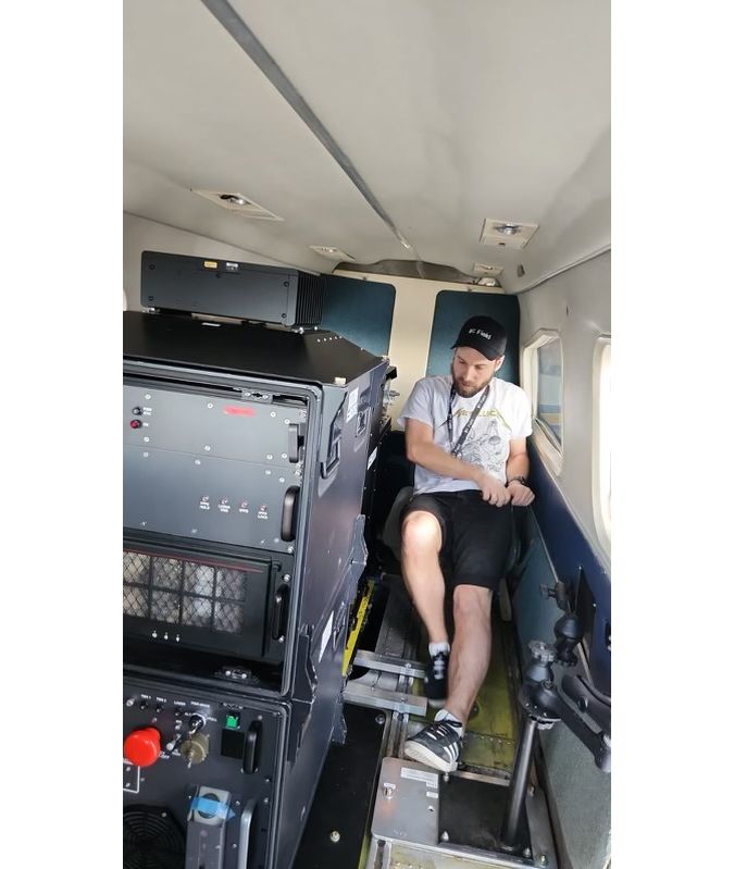
As the area was largely unsurveyed, it was exhilarating for the Lidar team to be the first to see the bathymetry. Large coral outcrops that were previously only known to local divers and fishermen will now be available to the world in the form of Lidar and MBES data. In the first few flights, the team observed perfectly formed coral domes peaking over 20 metres from the seafloor. Eventually, hundreds of these mounts presented themselves in subsequent sorties, contrasting with plateaued bars in the immediate offshore margin and numerous varieties of coral and reef structures – the bathymetry in Kiribati is truly world-class.
Wherever the team went, it was met by interested and engaged locals, all of whom were willing to help. At one point, the aircraft was in danger of being damaged by large chunks of coral during the take-off and landing procedures as the runway and surrounding area was made of coral. After a discussion with the locals, they crafted a bespoke pad for the aircraft to sit on and run its engines without the fear of coral being swept up and damaging the fuselage or propellers.
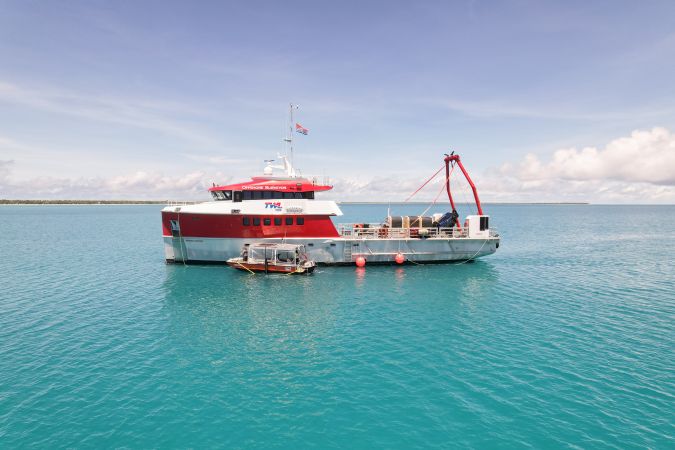
The MBES data acquisition was undertaken using survey launches operated from a mothership. The mothership acted as the base of operations and ensured that the presence of the crew did not put unmanageable strain on local resources. Further, engagement with local fishermen and inspection of satellite and drone imagery proved useful for scouting routes and identifying hazards and possible navigation passages through the reefs.
A requested outcome of the project was the desire to encourage local economies through the conduct of the survey work. To achieve this, IIC used local logistics and provision of stores wherever possible, stayed with local communities, hired village personnel, local coxswains and divers where appropriate, and rented local boats and vehicles. These activities provided a welcome financial boost for many of the Outer Island villages and allowed IIC personnel to develop relationships and engage with the locals.
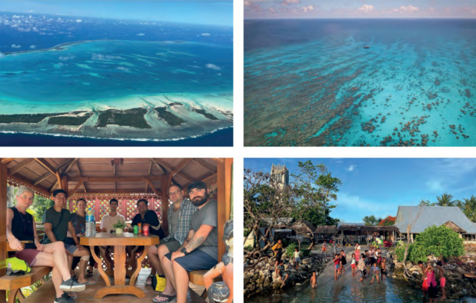
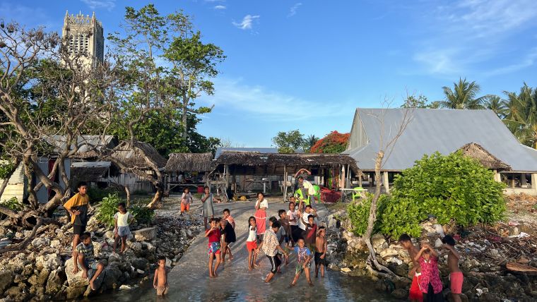
Another interesting aspect of this project was the requirement for engagement with local communities on the Outer Islands. This was undertaken under the leadership of KOITIIP staff and comprised meetings at each of the Islands, initially with the Islands’ Mayor and Secretary, then briefing at the Full Village Council. This Council comprised meeting with the elders or leaders from each of the villages in large traditional meeting huts. At these meetings, IIC, MICT and KOITIIP personnel described the activity, the outcomes for the Island and its people, and requested permission for access, local support to look after the equipment, and local logistics and vessels. These formal occasions were a privilege to be a part of, with the communities appreciating the benefits being presented and quickly – and normally emphatically – offering assistance. During these periods, the team made use of the local facilities, dining and living with the locals. On these Outer Islands, the locals depend on a balance of subsistence living by gathering food from the land and the sea, supplemented by some imported staples such as rice. Observing this enforced onto the team the importance of the work being undertaken, as it will assist in ensuring sustainable management, planning and preservation of both the land and ocean environments and therefore this way of life for future generations.
Conclusion
This article is too short to properly describe KOITIIP, its outcomes for the Kiribati people, the beauty of the environment, the challenges, the innovation or the incredible people involved. However, on completion of the surveys, the Government of Kiribati will have world-class, seamless coverage of the land and the seafloor, which it can use to plan and develop economic growth, improve safety and increase resilience.
These hydrographic surveys are not merely technical exercises, but vital tools that enable informed, strategic decisions affecting the safety and economic well-being of Kiribati. By meticulously planning and executing these maritime improvements, Kiribati is setting a remarkable example of how to harness the power of maritime resources for national development. This is an investment in the present that promises a safer, more prosperous future for all. By taking a holistic approach that involves local communities, using cutting-edge technologies and focusing on long-term sustainability, Kiribati is not merely navigating its waters but steering a course towards a brighter future.
Further information can be found in the Hydro International interview with Tion Uriam, national coordinator for hydrography and charting, Kiribati: Navigating climate change: Kiribati’s efforts to address sea-level rise, dated 14 March 2023.

Value staying current with hydrography?
Stay on the map with our expertly curated newsletters.
We provide educational insights, industry updates, and inspiring stories from the world of hydrography to help you learn, grow, and navigate your field with confidence. Don't miss out - subscribe today and ensure you're always informed, educated, and inspired by the latest in hydrographic technology and research.
Choose your newsletter(s)


