
Although navigational charts play an essential role in guaranteeing safe passage through our oceans, the information they contain also has many other uses beyond safe journeying from point A to point B.
The IIC Academy has put together a comprehensive training course, focused on all the aspects of nautical chart production and the utility of charts beyond their purpose for safe navigation. Recognized by the FIG/IHO/ICA International Board on Standards of Competence for Hydrographic Surveyors and Nautical Cartographers (IBSC), the S-8 Category B “Marine Geospatial Information Programme” is designed for those individuals interested in pursuing a professional career in Nautical Cartography.
Online Training Delivery
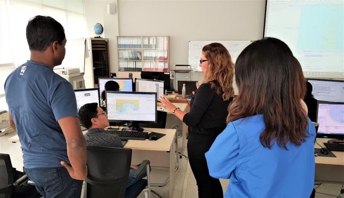
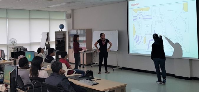
It is IIC Academy’s goal to offer the S-8 Category B programme in a flexible manner, in tune with the health and safety requirements of the world today. The programme will be delivered online via remote learning. This includes instructor-led webinars and e-learning modules, combined with students' teamwork and discussion forums. In conjunction with the instructor-led webinars and lectures, students will be required to solve practical tasks, undertake quizzes and complete exams, before completing the Comprehensive Cartographic Project.
The Comprehensive Cartographic Project will also be carried out as a remote project, under the control and presence of IIC educators depending on the world situation. It will be undertaken over a continuous period of four weeks immediately after completion of all the modules of the Programme. Safeguards will be in place to ensure the integrity of the process.
Additionally, the programme’s remote learning delivery will allow employees and employers the flexibility to customize the timing of the learning process so that it best fits within their work schedules, potentially enhancing the training through practical synergies.
S-8B Programme Content
The programme content is structured into six Modules and each Module is comprised of lectures and exercises that cover the entire S-8 Category B content. Each module is constructed as a blended learning experience and begins with an instructor-led webinar to introduce the topic. The aim being to graduate successful and confident students as Category B educated nautical cartographers.
Marine Geospatial Information Programme Modules
- Foundations of Marine Geospatial Information: Introduction to the programme. A brief history of nautical charting. Overview of charting in the world today. Wider contribution of charting in the evolution of marine informatics.
- Data Assessment and Compilation: essential aspects of nautical chart production, with an in-depth study of the S-57 Object Catalogue, data sources, standards, and production tools available in the market.
- Production and Validation: important aspects of nautical chart production, covering topics like chart design, quality controls on source data, sounding selection and chart validation.
- Marine Environment: Elements of Geology, Geophysics, Oceanography, Meteorology and Law of the Sea.
- Marine Spatial Data Infrastructures: Concepts, evolution, practical deployments, role of MSDI in marine national and regional development. The evolution of standards into S-100 and its role in MSDI.
- Remote Sensing: Remote sensing concepts, principles, and practice.
The course materials consist of enhanced audiovisual lectures, videos, and online resources. The distance learning materials are modified from the live lecture materials, adapted for e-learning and self-paced study.
Learning Management System (LMS)
IIC Academy manages the programme through its use of a cloud-based Learning Management System (LMS). The secure LMS can be accessed by students and instructors from desktops, tablets, and modern mobile devices. Native applications for iPhone & iPad are also available. Supported features include video conferencing (with record and replay), forums, message boards, progress monitoring, and schedule pages. Remote proctoring is utilized.
Programme Timeline
IIC Academy´s Marine Geospatial Information Programme – Global Delivery runs for a total of 22 weeks, from 6 September 2021 to 22 April 2022. Participants will have an elapsed period of 30 weeks in which students are expected to complete the 22 weeks of the programme via remote learning.
Interested?
Those interested in enrolling in the programme or wanting further information can visit:
www.iictechnologies.com/sites/default/files/S8B/S8BProgram.html
Or contact: