From Longitude by Fowl to Three-Point Sextant Fix
Prior to the development of modern navigation methods and modern charts, the mariner was left to his own devices both in approaching unknown and known coasts. Although Lucas Janszo...
Prior to the development of modern navigation methods and modern charts, the mariner was left to his own devices both in approaching unknown and known coasts. Although Lucas Janszo...

This month marks the 555th anniversary of the death of Prince Henry of Portugal, known as the Navigator, on 13 November 1460. Henry had set in motion a series of events that led to...
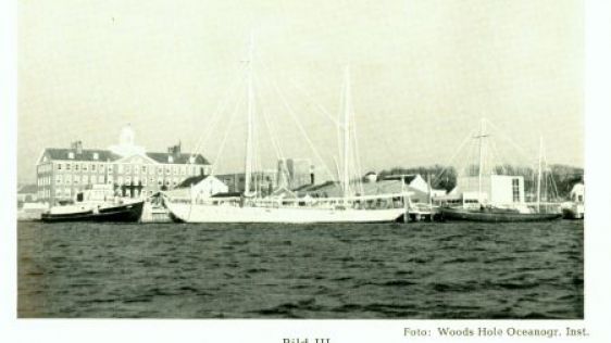
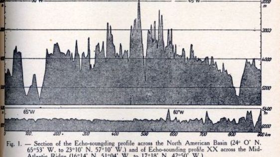
Following Maurice Ewing’s first cruise to the Mid-Atlantic Ridge, two more were made by the end of the 1940s. The first of these was led by Ewing while the second was led by...
Historically, perhaps the naval discipline most related to the work and skills of the hydrographer is naval mine warfare. Successful implementation requires knowledge of the config...
The Indonesian archipelago is one of the world’s most beautiful archipelagos. Home to over 17,000 islands, mountains rising to over 5,000 metres, including over 70 historical...
Follow Hydro International on Facebook, LinkedIn, Twitter or sign up for the newsletter! Don't miss the latest developments: join Hydro International!
 |  |  |  |
| 14.540 SUBSCRIBERS | 7.245 MEMBERS | 5.205 LIKES | 4.632 |

In times past, it was often the lot of the hydrographer and ocean scientist to have hand-me-down ships and vessels from the naval service or revenue service of various nations. Or,...
Prior to the year 1874, the Pacific Ocean was a blank slate with regard to the nature and depths of its seafloor. A few sporadic soundings had been attempted in the 1850s and Alexa...

Until the abolition of the Indian Navy in 1862 surveys of Indian and eastern waters were carried out by officers of the Bombay Marine and later by the Indian Navy. At first these s...
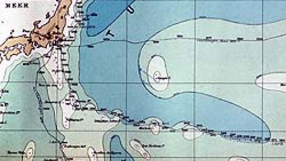
Thirty Years of Discovering the Mariana Trench On 23 March 1875, HMS Challenger sounded in 4475 fathoms at latitude 11°24N, longitude 143°16E to the southwest of the Marian...
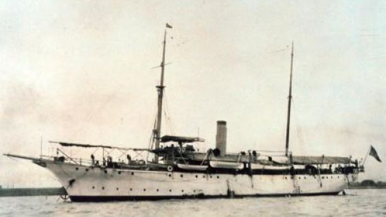
In 1899, a new ship was launched at the Crescent Shipyard in Elizabethport, New Jersey, USA. This vessel was a Coast and Geodetic Survey ship designed and constructed for rugged se...
A glance at a map of the Philippine Islands shows that the Sulu Sea is nearly an enclosed body of water: the Sulu Archipelago on the southeast; Palawan to the northwest; the main b...
Part 1 dealt with HMS Owen and the redoubtable nineteenth century hydrographer and explorer after whom she had been named. That Summer of 1953 the second of the two British surveyi...
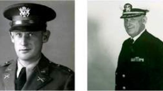
During World War II, a primary component of the success of American artillery was knowledge of United States artillery location, enemy target location and the direction to that tar...
In the era before the global positioning system and other reliable navigation aids, many imaginary and sometimes real features whose positions were grossly in error were found on c...
Above my desk hangs an ageing annotated photograph of a beautiful surveying ship which recalls a visit by the Directing Committee of the I.H.B. to Genoa in the Centenary Year of th...
1939 marked the beginning of a concerted programme to chart the Bering Sea area. The surveys in this area that were conducted prior to United States entry into the Second World War...
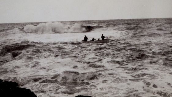
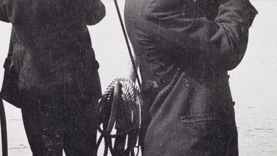
The ability to conduct inshore hydrographic surveys has always been dependent on small boats and the seamanship of those conducting the surveys. Besides the obvious use of small bo...
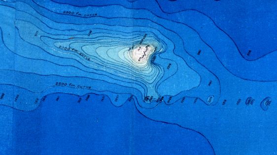
It is hardly possible to discuss the configuration of the deep ocean bed without eventually using the term ‘seamount’. Today, the existence of tens of thousands if...
European hydrographers surveying distant waters in the 18th and 19th centuries whenever possible used the native names for the features on their charts. When communication with loc...
After World War II, ship owners pressured the New Zealand Government to resume charting of coastal waters by the Royal Navy. Ships were now larger and most charts were a hundred ye...
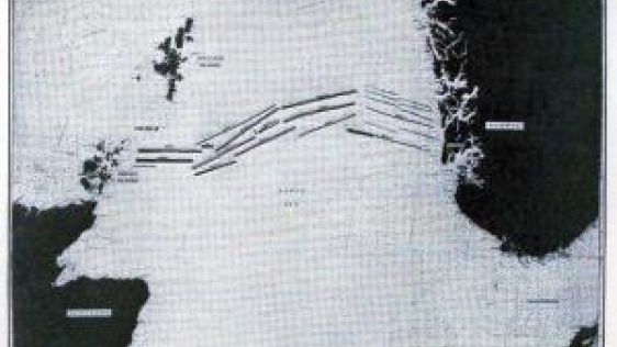
As noted in the previous issue of Hydro International, at least 200 seamounts had been discovered prior to the Second World War. The advent of acoustic sounding systems and the eff...

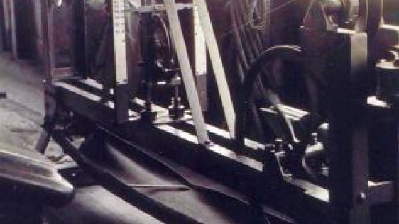
Radio-acoustic-ranging (RAR) navigation, developed within the US Coast and Geodetic Survey (C&GS), was the very first survey-quality navigation system that did not need to see...
<i>The New England Coasting Pilot</i> was the first folio of sea charts of the coast of North America. The work of an English naval officer, they covered the coastal wa...
On 8th October 1993, with the introduction of the Laser Airborne Depth Sounder (LADS) flown in a Fokker F-27 aircraft, the Australian Hydrographic Service could claim to be among t...

William Hutchinson was born in 1715 in Newcastle upon Tyne, England. Following his father's death he was compelled at the age of eleven to seek employment as a cabin boy on a Newca...

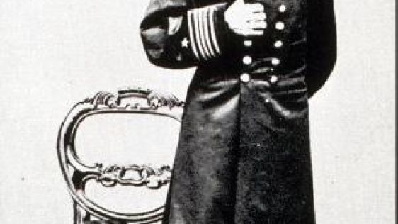
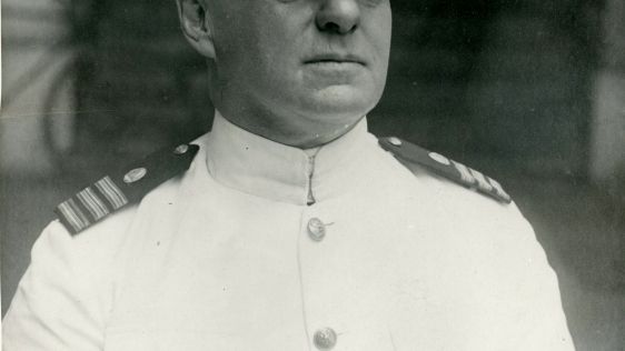
Lieutenant Pope McArthur was appointed a midshipman in the United States Navy in 1832 and followed a fairly conventional career path for the first few years of his career. He serve...
That Dieppe was a major centre of hydrographic progress in the 16th Century was recently chronicled in this Column (see Hydro international 2002 Vol. 6 No. 2). David Ross, a Scot,...
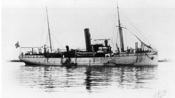
In the aftermath of the First World War Germany was made to deliver most of its warships to the allies. The gunboat Meteor, lying at a yard in Gdansk (Danzig), was excused under th...
The high cost of exploration in subarctic, often uncharted, waters was demonstrated in an unorthodox but convincing way by the 1974 grounding and sinking of the MV Minna off R...
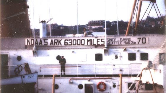
This year marks the 100th Anniversary of the Commissioned Corps of the National Oceanic and Atmospheric Administration (NOAA Corps). The law forming the service was signed on 22 Ma...
The great classical continent-spanning geodetic networks of the Nineteenth and Twentieth centuries had two major obstacles to overcome – distance and the curvature of the Ear...
Prior to the mid-19th century, the floor of the world ocean was virtually a clean slate. Nothing was known of the bottom of the deep sea with the exception of a few sporadic soundi...
During the California Gold Rush, many people from around the world left everything behind - including their jobs - to seek their fortune in California. A copy of one of the more in...
In 1958 Commander Hunt MBE, RN was about to undertake a survey in HMNZS <i>Lachlan</i> to complete NZ Chart 61, which included part of the rugged West Coast of the Sout...
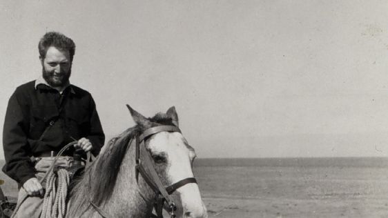
Although this is my second effort at contributing to the History column, I would like to use this issue’s column to introduce myself to the readership of Hydrointernational....
This site uses cookies. By continuing to use this website, you agree to our Cookies Policy. Agree