Hidden landscapes: the mapping of Ireland’s shelf geomorphology
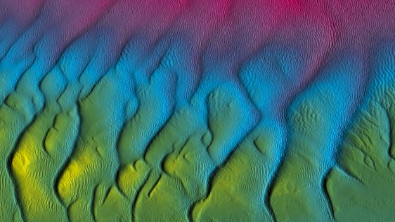
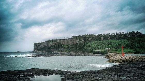
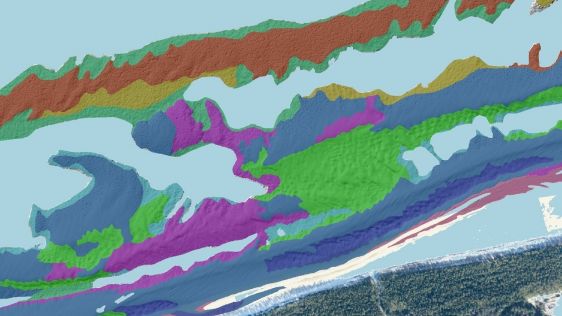
The Marine Geoscience Research Group at University College Cork, under the aegis of the Irish Marine Institute, has published the first high-resolution geomorphological map of most...

The Marine Geoscience Research Group at University College Cork, under the aegis of the Irish Marine Institute, has published the first high-resolution geomorphological map of most...

Given the Netherlands’ geographical location, it is unsurprising to find it has a long tradition of hydrography. The lowland, often below sea level, forms a delta where major...
In an era of great power competition, unmanned maritime systems (UMSs) have begun to take centre stage and are now on an accelerated development path for reasons that are clear. Li...
In the quest to unravel the mysteries beneath our planet’s water bodies, topobathymetric technologies emerge as a beacon of innovation. Among them, Lidar (light detection and...
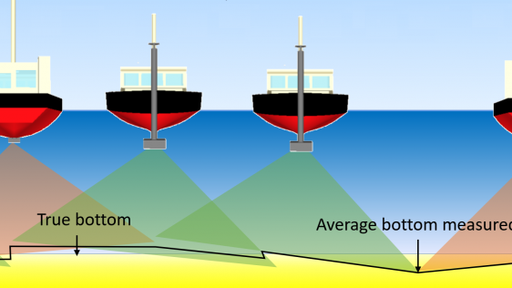
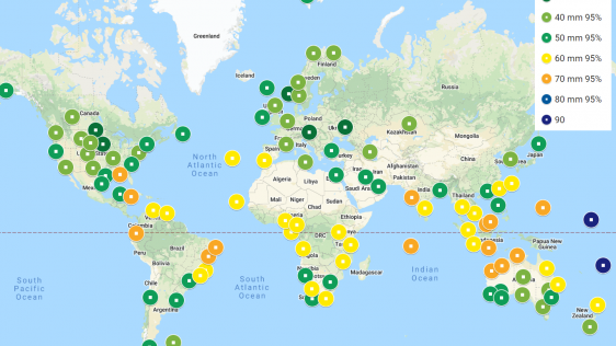
IHO standard S-44 is often used (or misused) to specify the quality of a hydrographic survey. While it is a useful tool, it is easy to misinterpret. One ‘misuse’ is to...
In a March 2023 blog, Microsoft founder, billionaire entrepreneur and philanthropist Bill Gates said: “The development of AI is as fundamental as the creation of the micropro...
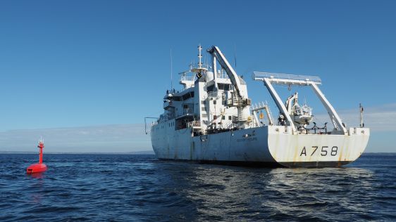
When contemplating the replacement of a research and survey fleet, a collective effort is required to meticulously curate an optimal new fleet, considering factors such as ship typ...
How do you perceive prospects in the hydrographic surveying industry in 2024, compared to the past couple of years? When contemplating the hydrographic sector holistically, which a...
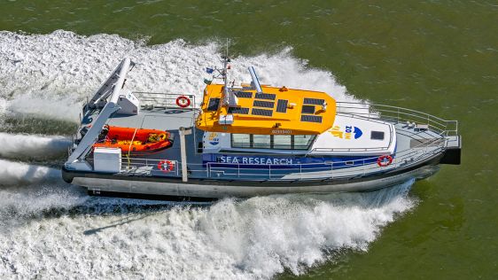
The development of unmanned and autonomous surface vehicles in recent years has triggered a new era in civilian and military maritime operations. One of the applications that is li...
Ocean data has a vital but underappreciated role to play as an enabler in shipping’s energy transition. In particular, it can help to unlock the short-term carbon savings tha...
Various attempts have recently been made to expand the scope of research in the maritime field through the convergence of cutting-edge technologies. One example is the remote class...
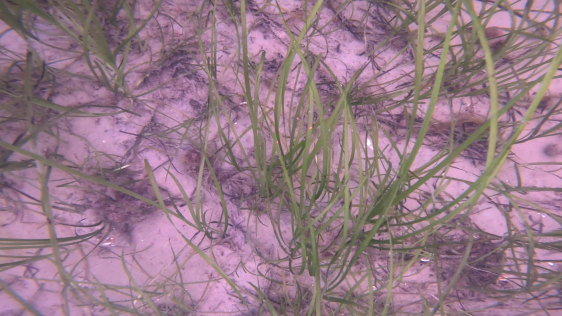
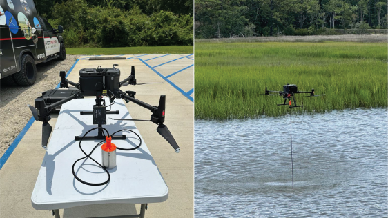
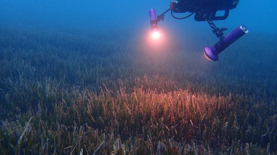
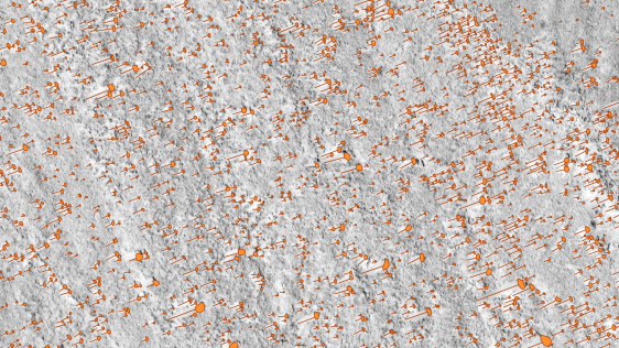
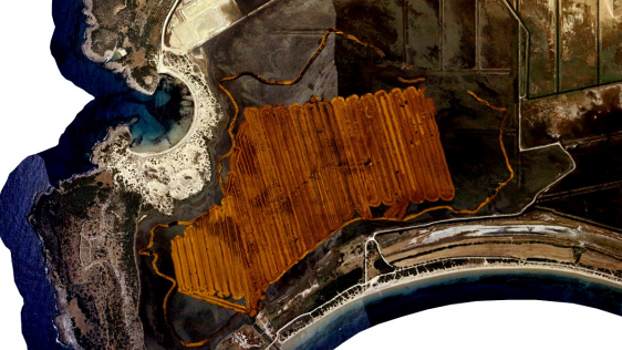
Seagrass meadows play an invaluable role as critical ecosystems that contribute significantly to marine biodiversity, carbon sequestration and coastal protection. In recent years,...
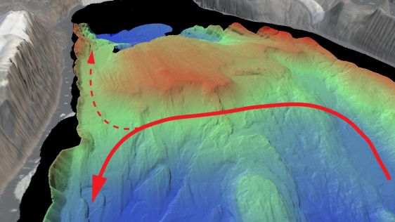
An understanding of the interplay between glaciers and the ocean is needed to improve sea-level rise projections. Seafloor mapping is critical in this pursuit, particularly where t...
In an era of environmental challenges and economic uncertainties, nations are earnestly seeking innovative ways to stimulate economic development, improve public safety and enhance...
On 24 January 2023, the European Union declared the Galileo High Accuracy Service (HAS) operational for testing, and it is scheduled to become fully operational in 2024. This...
Delving into the mysteries of the planet’s final frontier – the ocean – has long captivated human curiosity, with the origins of ocean exploration dating back to...
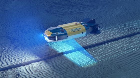
Combining AUV and ROV capabilities in a modular, hybrid unit improves functionality, while subsea docking technology expands the operational window of such a vehicle, allowing it t...
Some 290 shipwrecks lie in the Belgian part of the North Sea alone, with probably more than 1,000 in the entire North Sea, many of them silent witnesses to the two world wars. Unti...
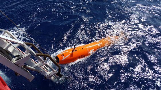
The ocean plays a crucial role in mitigating climate change, yet we lack detailed information on over 95% of the seafloor. This article explores planblue’s solution to accele...
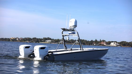
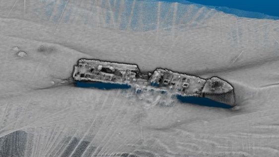
Fugro has utilized its cutting-edge hydrographic technology in Australia to locate the final resting place of the Montevideo Maru, which sank in 1942 with more than 1,200 people on...
Rapid technological advancements in AI, machine learning and automation urge the offshore industry to keep up to date with innovations and use them to make data acquisition and dat...
This article presents a novel methodological approach to understand and assess the suitability of airborne Lidar bathymetry for the automatic classification and mapping of the...
Unmanned surface vehicles (USVs) are increasingly being used for the mapping and management of shallow-water environments such as lagoons, rivers and estuaries, due to their econom...
The acquisition of bathymetric and sidescan data is essential for the Swiss energy company Axpo to maintain its hydropower infrastructure, especially as debris that glaciers dump i...

This site uses cookies. By continuing to use this website, you agree to our Cookies Policy. Agree