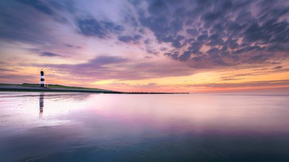
The evolution of Dutch hydrography
Given the Netherlands’ geographical location, it is unsurprising to find it has a long tradition of hydrography. The lowland, often below sea level, forms a delta where major...
Given the Netherlands’ geographical location, it is unsurprising to find it has a long tradition of hydrography. The lowland, often below sea level, forms a delta where major...
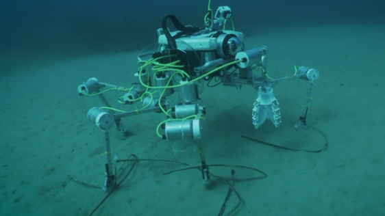
In an era of great power competition, unmanned maritime systems (UMSs) have begun to take centre stage and are now on an accelerated development path for reasons that are clear. Li...
In the quest to unravel the mysteries beneath our planet’s water bodies, topobathymetric technologies emerge as a beacon of innovation. Among them, Lidar (light detection and...
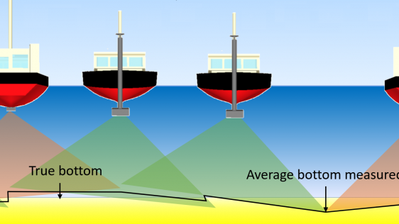
IHO standard S-44 is often used (or misused) to specify the quality of a hydrographic survey. While it is a useful tool, it is easy to misinterpret. One ‘misuse’ is to...
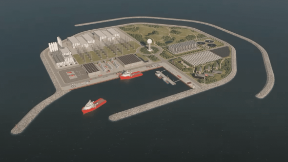
The Danish government is building an energy island in the North Sea, 80 kilometres off the coast, with the aim of accelerating the energy transition. The ambition is that the islan...
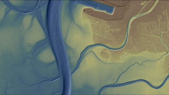
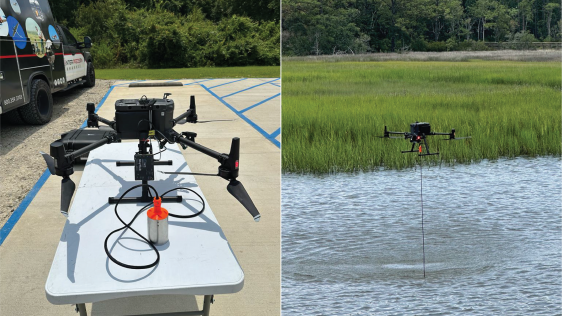
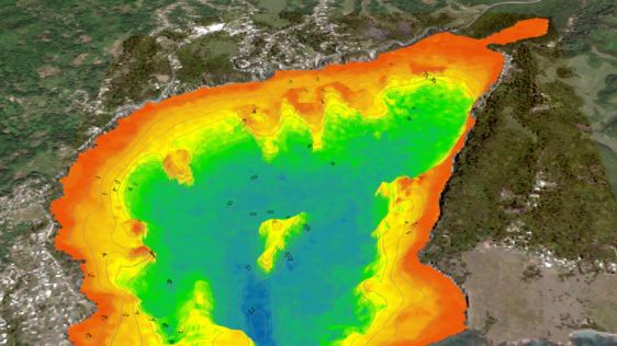
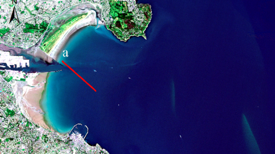
Morro Bay, a shallow coastal estuary located near San Luis Obispo, California, supports an abundance of wildlife and is home to a vibrant outdoor community. However, changes &...
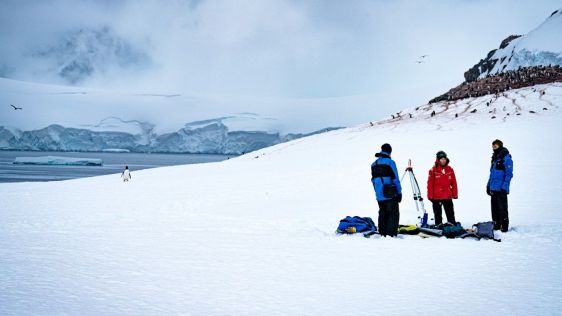
Capturing and measuring the environment in the Arctic and Antarctic is a particularly challenging job. The area of interest is often covered by a thick blanket of snow and ice, whi...
It is almost impossible these days to imagine geoinformation without GNSS, and most geodetic services have switched to GNSS to maintain their geodetic reference network rather than...
In recent years, terrestrial and extraterrestrial ocean research have increasingly joined forces to merge expertise and technical solutions in the exploration of marine systems on...
The national land agency in Jamaica has integrated satellite-based hydrography to benefit from time efficiencies, cost savings and improved safety as part of its hydrographic progr...
When looking to buy hydrographic processing software, it is important to establish the requirements in order to find the best software for the job at hand. The users’ technic...
Artificial intelligence (AI) first came to light in the 1950s, when the ability of a machine to undertake an operation and adapt to changing conditions without human input was skir...
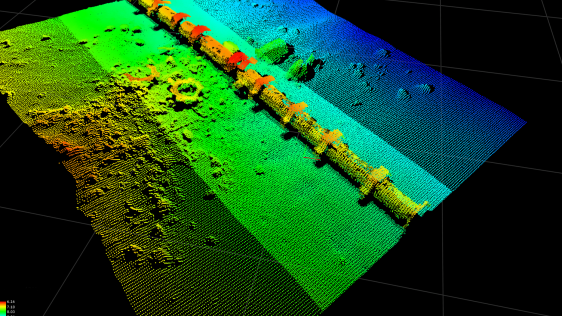
Seafloor pipelines are a critical infrastructure for oil and gas transport. Timely inspection is required to verify their integrity and determine the need for maintenance, as failu...
The shift towards an economy based on renewable energy and growing efforts to enhance nautical charting are two driving forces in the hydrographic industry, and the business will i...
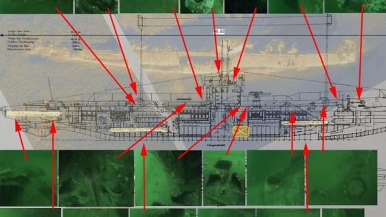
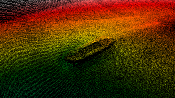
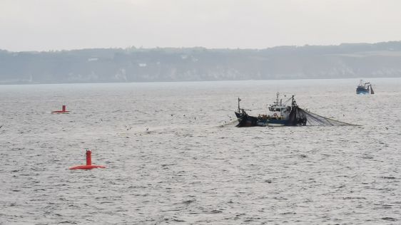
Countless ships and aircraft were lost at sea in the two world wars. Many of these went down with a large amount of fuel and munitions onboard, not to forget the countless sailors...
Machine learning is currently experiencing a surge of interest. Of course, what first come to mind are self-driving cars, face recognition and internet algorithms. However, while t...
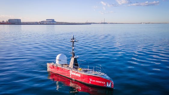
SHOM – the French national hydrographic service – is planning to replace most of its aging seagoing assets in the near future and, in this context, a four-week sea tria...
As the informed readership of Hydro International knows, the oceans sustain the planet. And, while there are many drivers of the changes to the Earth’s climate that now pose...
The South African Council for Geoscience recently launched an initiative to optimize marine geophysical data collection in South African waters. The main aim of the initiative is t...
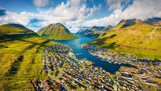
Crewless aerial mapping was recently chosen when surveying the Faroe Islands. For the small team, labour savings provided one advantage of a UAV-based approach. Another benefit was...
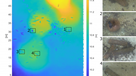
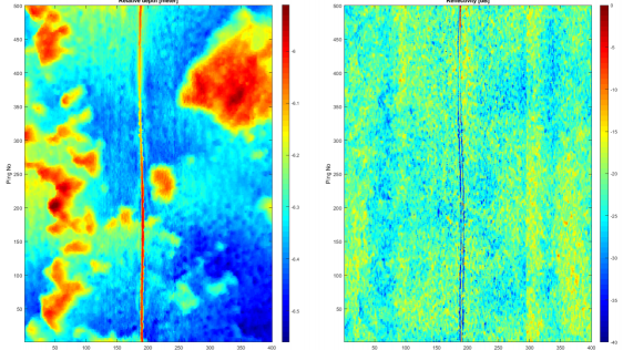
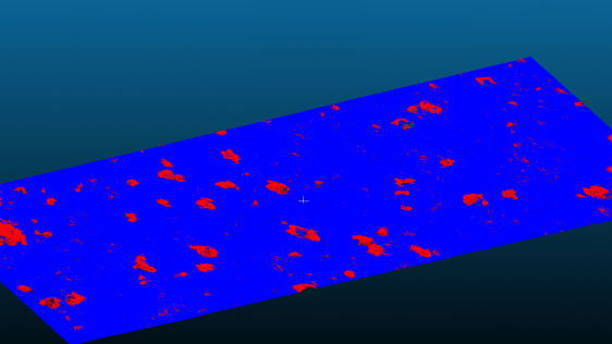
The detection of unexploded ordnance (UXO) in the sea is a demanding task. UXO survey data is acquired using a set of different sensors in different configurations and can span lar...
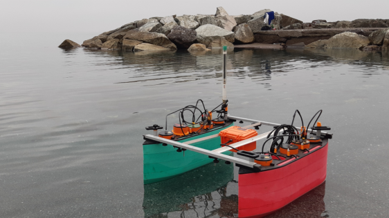
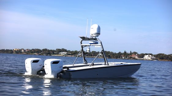
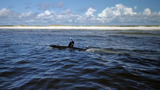
SWAMP (Shallow Water Autonomous Multipurpose Platform) is a new autonomous surface vehicle (ASV) whose design and development form the foundation for an innovative class of highly...
Coastal areas are highly dynamic environments that are subject to diverse pressures, both anthropogenic (e.g. urban development, fishing, habitat modification) and natural (e.g. st...
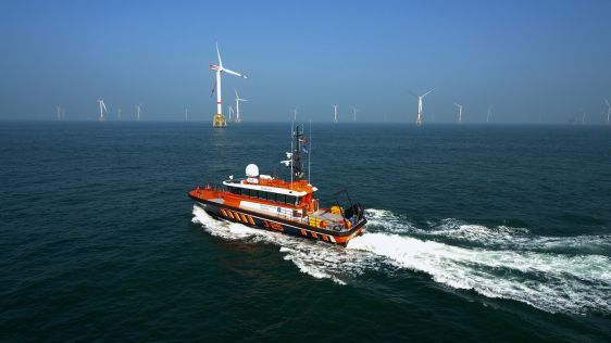
During the life cycle of offshore wind farms (OWFs), operators must maximize the uptime of wind turbines to generate as much energy as possible. As OWFs are constructed further fro...

This site uses cookies. By continuing to use this website, you agree to our Cookies Policy. Agree