Mapping through fluid mud
The presence of suspended sediments in water bodies presents significant challenges for the dredging industry. Existing methods to determine nautical depths are intrusive single point methods relying ...
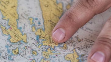
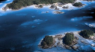
Hydro International's "Case Studies" section offers in-depth analyses of real-world hydrography projects. These studies provide insights into the practical application of technologies and methodologies in marine environments, helping professionals tackle challenges effectively and foster innovation.
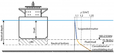
The presence of suspended sediments in water bodies presents significant challenges for the dredging industry. Existing methods to determine nautical depths are intrusive single point methods relying ...
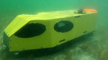
Combining the DriX uncrewed surface vehicle (USV) and the FlipiX remotely operated towed vehicle (ROTV), Exail has developed a unique solution enabling fully autonomous and remotely operated surveys. ...
Rijkswaterstaat, part of the Dutch Ministry of Infrastructure and Water Management, is responsible for managing and maintaining the main infrastructure facilities in the Netherlands. As part of its ef...
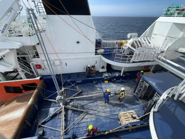
Working in the ocean environment can be challenging and dangerous. It requires skilled professionals using cutting-edge technology to measure and map the physical features of the underwater environmen...
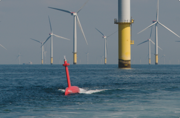
With hundreds of new offshore wind projects in development around the world and annual growth of almost 30%, offshore wind is a rapidly maturing renewable energy technology that offers great potential...
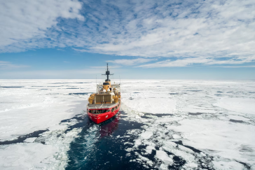
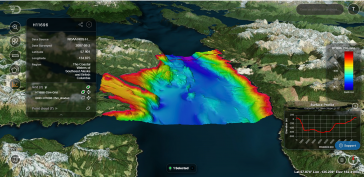
When research institution the Geological Survey of Denmark and Greenland (GEUS) needed to survey the ocean floor in the Davis Strait off the coast of Greenland, it partnered with KUM Offshore (KUMO), ...
An estimated 95% of the oceans remains unexplored today, implying a huge market opportunity for innovative marine survey solutions. While the boom in offshore renewables projects will certainly contin...
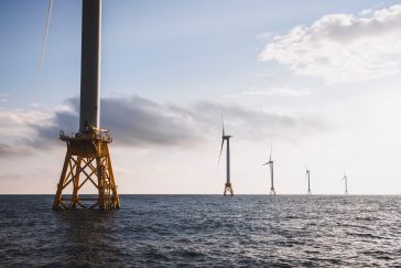
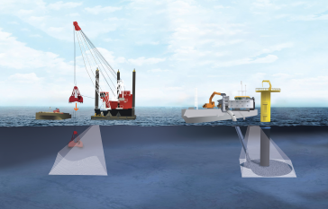
Offshore wind energy development, which is expanding rapidly along the East Coast of the United States, has the potential to play an important role in US efforts to combat the climate crisis and build...
Cartographers working in hydrographic offices and ENC editors have the responsibility of processing bathymetry datasets to generate ENCs compliant with the S-57 IHO standard. This is a time-consumi...
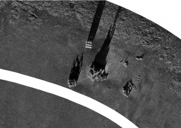
In July 2022, an environmental disaster hit the Oder River, a vital waterway for both Poland and Germany. The mass die-off of fish triggered an extensive investigation into the possible causes, but co...
S. T. Hudson Engineers, Inc. is a pioneer in state-of-the-art marine engineering and total harbour facilities and a specialist in marine technical services. It has provided professional consulting, s...
The National Oceanic and Atmospheric Administration (NOAA) contracted NV5 Geospatial to define the shoreline in an extremely complex area of south-east Alaska as part of the NGS Coastal Mapping Progra...
This site uses cookies. By continuing to use this website, you agree to our Cookies Policy. Agree