More Data with Less Effort and Risk
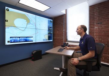
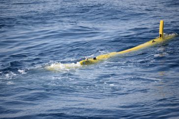
DEA Marine Services, a division of David Evans and Associates, Inc. (DEA), of Vancouver, Wash., has invested in and utilized Sea Machines Robotics’ autonomous command and remote helm control system ...

Hydro International's "Case Studies" section offers in-depth analyses of real-world hydrography projects. These studies provide insights into the practical application of technologies and methodologies in marine environments, helping professionals tackle challenges effectively and foster innovation.
 Case Study
DEA Marine Services, a division of David Evans and Associates, Inc. (DEA), of Vancouver, Wash., has invested in and utilized Sea Machines Robotics’ autonomous command and remote helm control system ...
 Case Study
A competition was launched by the UK’s Defence Science and Technology Laboratory (DSTL) in an effort to develop an autonomous survey vehicle that could survey rivers and river banks to find sites fo...
Over the past decade, the hydrographic survey community has benefited greatly from portable multibeam echosounders utilizing highly integrated electronics and powerful computational platforms. These s...

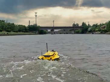
Seafloor Systems was recently contracted by the U.S. Geological Survey (USGS) to develop two custom HydroCat-180 unmanned surface vessels (USVs) that will be used to monitor the impacts of saltwater i...
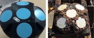
Nitto Denko Corporation (hereafter: Nitto) has developed a new anti-biofouling protection film to prevent the build-up and growth of biofouling. The film is ready-to-stick and its specially treated su...
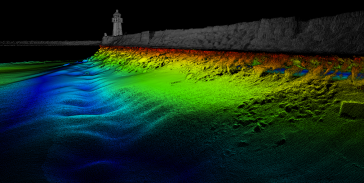
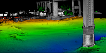
Skansen is a historic area in the city of Trondheim in central Norway and home to the Skansen Bridge, a 52m span bascule railway bridge that opens for marine traffic to access the Trondheim Fjord. The...
This paper explores the various features of the Apache USV series for efficient seafloor-level mapping. The CHCNAV hydrographic survey software is used for data recording and analysis. It provides res...
High-resolution bathymetric surveys support aquaculture research and increase navigational safety. In a case study, Tim Webster reports how this is done at Cape John Peninsula in Canada. In a second c...
 Fugro
Fugro
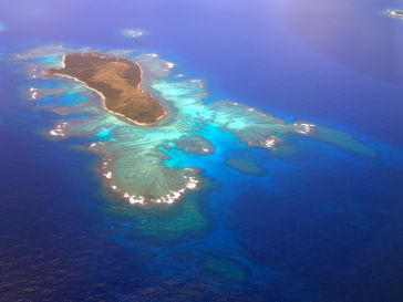
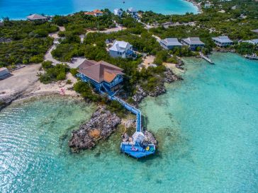
Insight into the use of the Rapid Airborne Multibeam Mapping System (RAMMS) for coastal and nearshore mapping at the paradisal Turks and Caicos Islands. The Rapid Airborne Multibeam Mapping System, RA...
As announced in early 2018, ECA Group signed a cooperation agreement for subsea robotic services to Oil & Gas companies with a leasing offer on its latest generation A18D AUV creating a new dimension ...
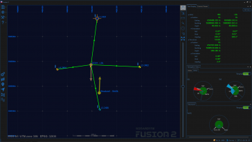
Complex set-up operations, multiple topside systems and interfaces, and arduous workflows; these are all now in the past. Sonardyne’s Fusion 2 survey software combines intuitive workflows with faste...
Scientists from the Dublin Institute for Advanced Studies (DIAS) have undertaken a 21-day marine science mission, deploying 18 ocean-bottom seismometers (OBSs) at a series of locations on the floor of...
This site uses cookies. By continuing to use this website, you agree to our Cookies Policy. Agree