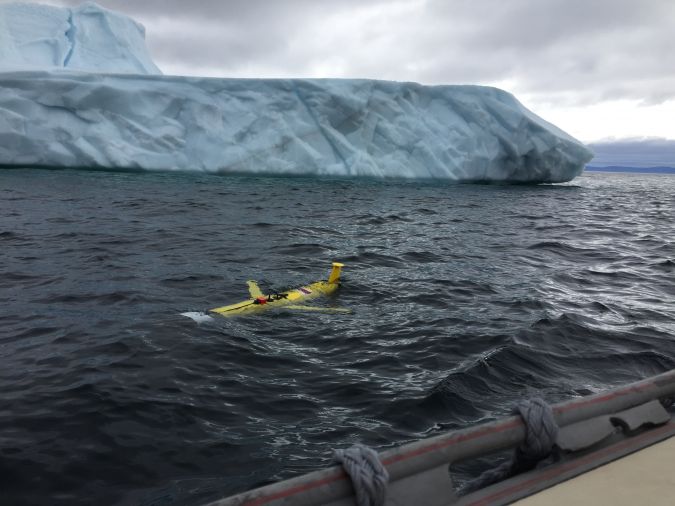
Working in the ocean environment can be challenging and dangerous. It requires skilled professionals using cutting-edge technology to measure and map the physical features of the underwater environment, whether for navigational safety, coastal zone management, mapping of physical structures or seabed topography. Often, data is collected in remote locations or locations with unpredictable and harsh weather conditions. There may be limited visibility and extreme depths with submerged hazards such as wrecks or debris. Remote areas can make hydrographic surveys a significant challenge requiring equipment reliability for data collection and accuracy. Teledyne Marine is no stranger to working in harsh and challenging environments worldwide, using advanced technologies to enhance data collection efficiency and precision. Teledyne Marine, a leading provider of marine technology solutions, has been at the forefront of ocean science, developing tools and technologies that enable scientists and engineers to explore, monitor and collect data throughout the world’s oceans.
Effective monitoring of environmental change requires sustained and widespread observations. The span of these marine observations is from the sea surface to the sea bed, from polar to tropical regions and on a timescale from seconds to years. To meet this challenge, ocean scientists and engineers have deployed proven observational methods and required new ways to take measurements. They explore, monitor, observe, detect, collect and classify. Teledyne products used in this pursuit include profiling floats for observing global circulation, uncrewed gliders for measuring upper-ocean waters, various vehicles for mapping, inspection and survey, navigation systems for pinpoint positioning, echosounders for mapping sea beds, releases and buoyancy for deep sea moorings, modems for underwater communications and profilers for measuring water currents.
Monitoring ice shelves in Antarctica
Ice shelves in Antarctica have become an iconic image of Earth’s changing climate, and scientists are working to understand the mechanisms that drive their melting. Under-ice heat flux affects the rate of deterioration of an ice shelf, and a specific research focus is a mechanism called ‘channelling’. The melting of ice at great depths causes upwelling of fresh water, which melts the underside of the shelf, forming channels in the ice that work their way upward. This leads to the weakening of the ice shelf, eventual cracking and, finally, complete detachment.
Using uncrewed vehicles under ice is an emerging method for investigating these large detachments. This approach reduces the risk to human life in gathering this type of data and enables researchers to reach remote locations and depths. Teledyne Slocum gliders, which are capable of moving at various depths throughout the water column, have become indispensable tools for monitoring ice melting beneath Antarctic ice shelves. Their ability to operate autonomously in harsh and remote environments and their advanced sensing capabilities offer an unprecedented view of the intricate interactions between ice and seawater. By providing crucial data on ice shelf melting, these gliders contribute significantly to climate research, allowing scientists to make informed decisions on environmental conservation and the sustainable management of our planet’s valuable resources.
Unravelling the secrets of the Southern Ocean
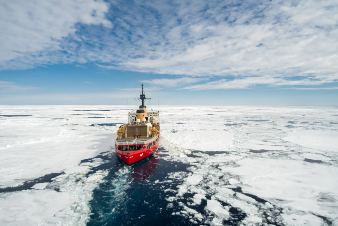
The Southern Ocean is vital to the Earth’s climate and global ocean circulation, absorbing large amounts of CO2 and heat that would otherwise remain in the atmosphere. The Southern Ocean is a sensitive indicator of the worldwide ocean’s response to changing climate and has expansive regions where strong, deep flows meet rough bottom topography. Despite its remote and challenging location, modern technology has allowed oceanographers to conduct enduring studies in areas like the Drake Passage, infamous for its rough seas. Researchers have used current profilers to uncover widespread, intense mixing near the Drake Passage and over irregular topography, offering insight into the region’s influential deep currents.
Several international teams have mounted field programmes looking for deep signatures of turbulent mixing created by breaking underwater internal waves. In addition to heat transfer, this process also causes vertical exchange of other water properties, such as nutrients. Research cruises through the Southern Ocean have lowered current profilers during hydrographic casts for two decades. Transects of full-depth current profiles have revealed the spatial distribution of the region’s solid and deep currents. These current profiles provide input to a statistical description of mixing in the ocean, giving researchers a valuable picture of how mixing nutrients in the Southern Ocean influences climate regulation, carbon sequestration, ecosystem dynamics, ocean productivity, global ocean circulation, ocean-atmosphere interaction and climate change impacts. Comprehensive knowledge of nutrient dynamics in this region is vital for addressing pressing environmental challenges, promoting marine conservation efforts and formulating effective climate change mitigation and adaptation strategies globally.
Innovative solutions for infrastructure
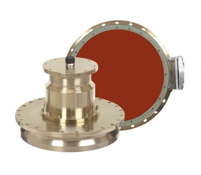
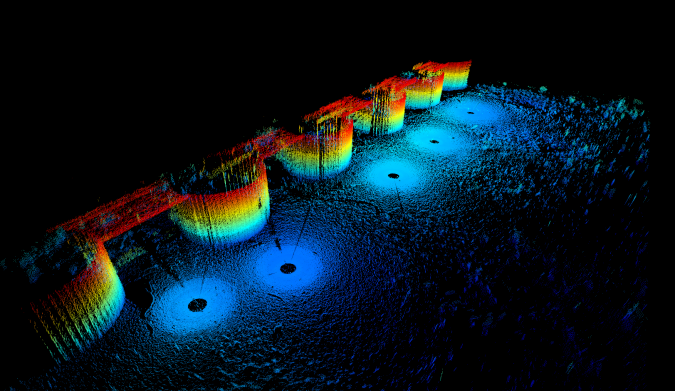
Teledyne’s marine technology is not limited to ocean research; it has also proven instrumental in infrastructure maintenance and safety. For instance, the Minnesota Department of Transportation (MnDOT) utilized Teledyne’s 3D mechanical scanning sonar to inspect bridge footing damage and scour, a dangerous phenomenon caused by swift-moving water that can compromize bridge supports. The sonar scanning capabilities provided by Teledyne allowed inspections even in harsh winter conditions, ensuring the safety and durability of critical infrastructure.
Teledyne works extensively with civil engineering dive and inspection teams worldwide to help enhance its customers’ deliverables using 2D and 3D imaging sonar. The data from these sonars helps prioritize engineering decisions for inspection, repair and maintenance and verifies that work is completed to specifications.
Teledyne’s commitment to advancing ocean science
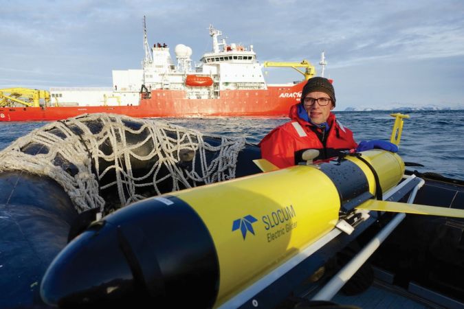
Teledyne’s role in advancing ocean science and technology is undeniable. Through innovative tools such as uncrewed gliders, current profilers and 3D scanning sonars, Teledyne Marine has revolutionized ocean exploration, environmental monitoring, seafloor mapping and infrastructure maintenance. By collaborating with scientists, engineers and organizations worldwide, Teledyne continues to push the boundaries of marine technology. As the challenges of exploring the ocean’s depths persist, Teledyne remains committed to providing solutions that benefit scientific research, environmental conservation and human safety on both land and sea. Teledyne Marine empowers scientists and professionals worldwide to better understand, protect and harness the vast potential of our oceans by providing essential tools and solutions. As our planet faces unprecedented environmental challenges, Teledyne Marine’s dedication to advancing ocean science offers hope for a sustainable and thriving future for our oceans and the life they support.
