Pioneering ocean mapping for a better world
Charting the ocean’s depths: Seabed 2030 and global collaboration
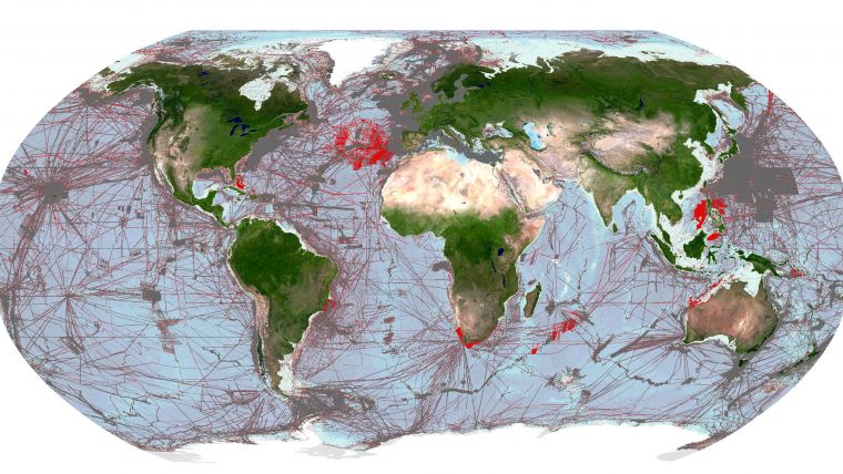
Delving into the mysteries of the planet’s final frontier – the ocean – has long captivated human curiosity, with the origins of ocean exploration dating back to 5,000 BC. But even today, the ocean largely remains a mystery, concealing vital knowledge. The Nippon Foundation-GEBCO Seabed 2030 Project hopes to inspire the complete mapping of the ocean, which covers over 70% of the Earth’s surface, by 2030. This ambitious endeavour requires global cooperation but promises a sustainable future.
The Earth, with its vast ocean and uncharted depths, has always been an enigmatic realm, holding mysteries that elude human comprehension. Only a fraction of the seafloor has been explored, leaving the majority of this critical ecosystem shrouded in darkness, yet the ocean’s influence extends far beyond its depths.
Providing over half of the oxygen produced on the planet, the ocean sustains life on Earth. It is the lifeblood of communities – offering food and livelihoods to over three billion people around the globe – and often the unsung hero in the fight against climate change as the ocean captures a staggering 25% of all human-made carbon emissions. In this era marked by unprecedented environmental challenges, comprehending the intricacies of the planet’s vast ecosystems has never been more paramount.
Born out of a collective global effort, The Nippon Foundation-GEBCO Seabed 2030 Project is an initiative that not only reflects the growing awareness of the fundamental role of the ocean, but also exemplifies the power of international collaboration in pursuit of a common goal.
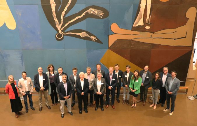
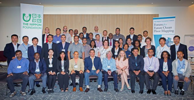
The idea for Seabed 2030 was first conceived at the 2016 Forum for Future Ocean Floor Mapping in Monaco. At this pivotal event, scientists, hydrographers, oceanographers, policymakers and environmentalists from various sectors across the globe convened to address the critical knowledge gap in the planet’s submerged frontier. Seabed 2030 was officially launched the following year at the first-ever United Nations Ocean Conference in New York. The project was also one of the first flagship programmes of the United Nations Decade of Ocean Science for Sustainable Development (Ocean Decade), and is aligned with SDG 14: ‘to conserve and sustainably use the oceans, seas and marine resources for sustainable development’.
Multifaceted benefits of a complete map
The benefits of creating a detailed and comprehensive seabed map are multifaceted. Enhancing the knowledge and understanding of the seafloor allows for increased awareness of key geological processes, the adoption of best practices for resource management and the ability to make informed decisions to ensure a sustainable future for the planet.
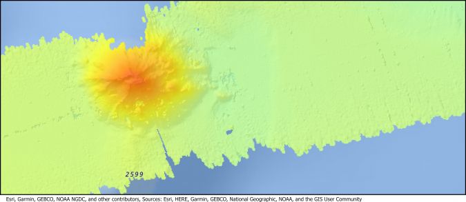
A comprehensive seabed map sheds light on the intricacies of ocean floor topography, underwater volcanoes and tectonic plate movements, offering a wealth of information that aids the prediction and mitigation of natural disasters such as tsunamis and earthquakes. It also supports environmental conservation efforts. The ocean is home to a range of marine ecosystems, many of which remain undocumented. Mapping the seabed provides vital insights into these ecosystems, enabling the identification of critical habitats and vulnerable species so that targeted conservation efforts to preserve the delicate balance of life in the ocean can be implemented.
Resource management is another area that benefits greatly from a complete map of the ocean floor. With accurate information about the seabed’s composition and resources, nations can make informed decisions about its sustainable management, including that of fishing resources.
Seabed 2030’s goal encompasses all these tangible benefits and more. It is inspired by the recognition that a healthier, better-understood ocean is key to addressing the global challenges present today – from food security to climate change. It is a call for a global commitment to ensure the well-being of the planet.
The role of global collaboration
Seabed mapping is no new feat, and ocean mapping has taken place since the early days of maritime exploration. In fact, the General Bathymetric Chart of the Oceans (GEBCO), the only organization with a mandate to compile global bathymetry data, just this year celebrated its 120th anniversary, having been founded in 1903. Fast forward to 2017, and Japan’s largest philanthropic organization, The Nippon Foundation, joined forces with GEBCO to create Seabed 2030, to act as a catalyst to the long-standing efforts. GEBCO itself is a joint programme of the International Hydrographic Organization (IHO) and the Intergovernmental Oceanographic Commission (IOC) of UNESCO.
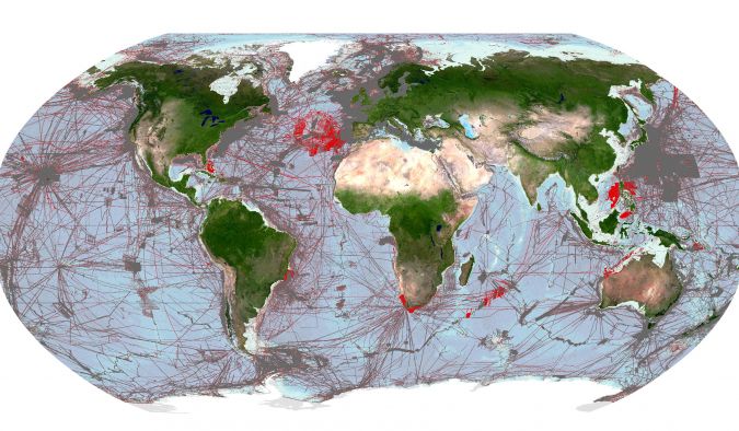
When Seabed 2030 was launched in 2017, only 6% of the ocean had been mapped to modern standards. This figure has grown considerably, with just under a quarter – 24.9% – of the entire ocean floor now charted in the GEBCO grid. Mapping the entire ocean floor is an ambitious task that can only be achieved through international collaboration. Since its inception, Seabed 2030 has entered into over 50 partnerships with governments, industry, academic institutions and more across the globe, without which its goal would be unattainable.
Spotlight on Fugro
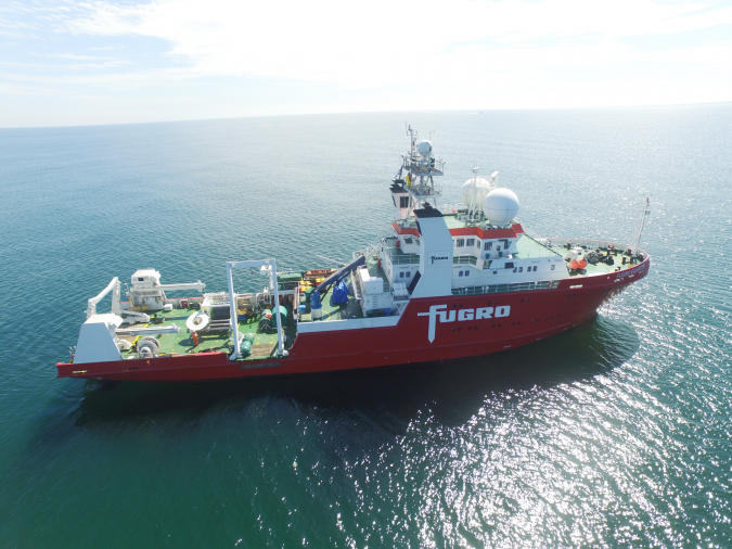
Fugro is one of the founding members – and the first private sector member – of Seabed 2030. Its involvement dates all the way back to the 2016 Forum for Future Ocean Floor Mapping, when Seabed 2030 was merely a concept. Recognizing that global progress in ocean mapping would require a cross-sectoral approach, Fugro leveraged its expertise as an international survey company to support this ambitious initiative.
The company focused its support on two key areas: encouraging its marine-based customers to share privately owned ocean mapping data, and acquiring and sharing data itself. The first path proved more difficult than anticipated. While Fugro had many positive conversations with customers about data sharing, moving from general interest to concrete agreements proved challenging for multiple, complex reasons. For instance, a company may have been willing to share the bathymetry developed for an offshore energy project, but the government-issued lease agreement they operated under may not have allowed it.
Meanwhile, Fugro had far greater success with its own data development and sharing programme. This was made possible by early investments in remote command-and-control technology, which allowed the company to collect high-resolution bathymetry while travelling to and between projects. Fugro’s philanthropic ‘in-transit’ bathymetry programme started in the Americas region with just one survey vessel in 2016. Today, nine of the company’s global survey vessels are participating, with contributions of Fugro bathymetry now totalling more than 2.36 million km². By 2025, the company aims to have 90% of its global fleet collecting in-transit bathymetry in support of Seabed 2030.
Expanding private sector involvement through the Ocean Decade
As with Seabed 2030, Fugro was involved in the early planning stages of the Ocean Decade. Through that process, the company realized that making privately-owned bathymetry available for public use would be best accomplished not through bilateral discussions with customers, but through engagement with the private sector community.
This is what ultimately led to Fugro and IOC/UNESCO forming a partnership agreement in November 2021 to improve the coordination of, and access to, global ocean science data. Through this partnership, the parties have formed a working group to help build a digital ecosystem to manage and distribute ocean data and interoperable marine science. They are also forming a group of private sector companies that collect or own ocean science data. Known as the Ocean Decade Corporate Data Group, this collective aims to address the challenges of sharing ocean data, developing solutions and best practices for industry.
Fugro and IOC/UNESCO officially launched the Corporate Data Group in February this year. It comprises eight members from a diverse range of marine industry sectors, with plans to expand to 15. While its work encompasses a wide spectrum of ocean science interests, bathymetry has taken centre stage as a fundamental data layer with a well-established foundation, thanks to the efforts of Seabed 2030 and the robust infrastructure provided by the GEBCO grid.
Seabed 2030 is collaborating with the working group in an advisory capacity, sharing insights gained from its interactions with the private sector regarding data sharing challenges. Its guidance is helping to inform a comprehensive strategy for making more privately owned bathymetry accessible to the public. This includes tackling sensitive issues related to government permissions for releasing data developed within lease agreements or permits.
The role of technology and partnerships
By integrating existing bathymetric data from all sectors into the GEBCO grid, it is estimated that we can chart an additional 15–20% of the world ocean. If achieved, that still leaves a lot of ocean to map and a lot of questions about how that will be completed. Once again, partnerships and technology will lead the way.
On the partnership front, contributions of new bathymetry will remain important, but the introduction of large-scale mapping programmes will also be required. Existing regional intergovernmental partnerships, such as the All-Atlantic Ocean Research and Innovation Alliance (AAORIA), can serve a critical function in supporting these efforts by providing a platform for collaboration and funding.
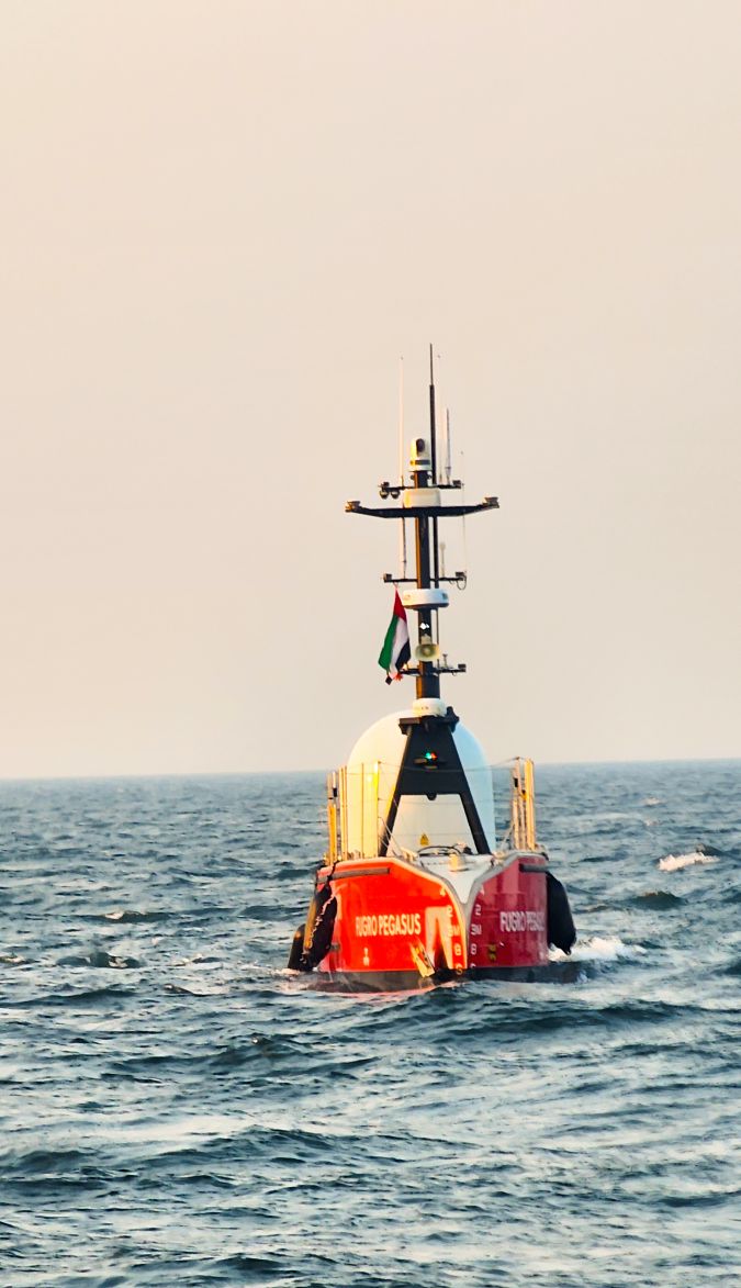
Technology-wise, all signs point to remote and autonomous technologies. When Seabed 2030 was first conceived, there were no robots surveying the ocean, but today uncrewed surface vessels (USVs) collecting deepwater bathymetry are a proven reality. Collaboration has played a starring role in this advancement, perhaps most notably through the Shell Ocean Discovery XPRIZE. This global, three-year competition incentivized the development of rapid, uncrewed high-resolution ocean mapping technologies, including the winning SEA-KIT USV technology that is now used by Fugro in Europe, Australia and the Middle East.
The goal now is for industry to scale USV and other remote and autonomous capabilities so that high-resolution ocean basin mapping can be accomplished for well-organized regional partners safely, efficiently and with minimal environmental impact.
United in discovery
Seabed 2030 was created to act as a catalyst to the long-standing endeavour already underway to chart the ocean – but its mission cannot be achieved alone. It is the result of unwavering collaboration among nations, institutions and corporations alike – and Fugro’s unwavering commitment to Seabed 2030 exemplifies the power of private sector involvement in addressing the most pressing global challenges. Through cutting-edge technology, innovation and expertise, Fugro has helped to significantly advance the project’s mission, bringing us closer to the day when we will have a complete map of our ocean’s depths.
In mapping the ocean floor, a path towards a more resilient, equitable and sustainable future is charted. The completion of this monumental task by 2030 requires the continued support and collaboration of governments, industry partners, research institutions and individuals worldwide. The international community must redouble its efforts and invigorate innovation.
Unveiling the Earth’s hidden depths to acquire the knowledge needed to safeguard the planet for generations to come has now become a uniquely important goal in which everyone has a role to play.


Value staying current with hydrography?
Stay on the map with our expertly curated newsletters.
We provide educational insights, industry updates, and inspiring stories from the world of hydrography to help you learn, grow, and navigate your field with confidence. Don't miss out - subscribe today and ensure you're always informed, educated, and inspired by the latest in hydrographic technology and research.
Choose your newsletter(s)


