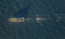
Found 5651 results
Sort by

IVS 3D

  Interactive Visualization Systems' (IVS3D) was founded in 1995 as the developer of the Fledermaus 3D visualisation and analysis software suite. The software is used internationally by government, commercial and...

Read more

3D Web-mapping

Google Earth has become a popular 3D web-mapping viewer, mainly due to the richness of satellite imagery in its primary database. However, the database contains very limited marine data. While...

Read more

3D Web-Mapping

While Google Earth is the best known 3D web-mapping viewer currently in the public domain, there are alternative virtual globe viewers available. In particular, this article focuses on the NASA...

Read more

3D Web-Mapping

While Google Earth is the best known 3D web-mapping viewer currently in the public domain, there are alternative virtual globe viewers available. In particular, this article focuses on the NASA...

Read more

GeoChirp 3D Imaging

The GeoChirp 3D from GeoAcoustics Ltd provides the shallow-survey market with a new tool to image sub-surface structures and buried objects. The GeoChirp 3D provides a three-dimensional image of the...

Read more