Found 75 results
Sort by

Triton hydrographic systems for DISHIDROS

Triton Imaging, Inc., in collaboration with its Southeast Asia Representative HYDRONAV Services and their associated representative office in Jakarta PT Hidronav Tehnikatama, participated in the installation and commissioning of two...

Read more

'As it Is'

The Military Survey Department of the Armed Forces is the sole federal mapping agency and entity in the United Arab Emirates (UAE). It is responsible for co-ordinating, processing and disseminating...

Read more

Mesuris SA

Mesuris SA was founded in France in July 1993 with its main initial purpose being the distributor of survey equipment within France. The company headquarters are in St Grégoire France,...

Read more

Atlantis Initiative Online

The Atlantis Initiative, a collaborative project that is working on ways to provide better information to address the impact of climate change and flood risks, is now live on the...

Read more

The Hidrovia Project

The Rivers Plate and ParanĂ¡ in Argentina have much natural sedimentation. In 1993 the Argentine government issued a tender for dredging and signalization of these vital waterways. The concession runs...

Read more

LBL Array for Hostile Topography

The unique seabed topography of oil & gas field 'Ormen Lange', in the North Sea near Norway makes it very difficult to design pipeline routes and associated structures in compliance...

Read more

PDS2000 contract by Van Oord

The dredging and marine contractor Van Oord decided to upgrade their RESON PDS2000 single-beam licenses to full PDS2000 multi-beam licenses. In addition they also purchased the new PDS2000 interactive 3D...

Read more

Data Integration for Coastal Surveying

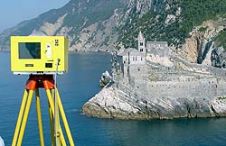
When surveying the coastline, the integration of bathymetric (below sea level) and laser scanning (above sea level) data causes problems due to the different imaging properties. However, by ensuring that...

Read more