Spanish Navy Extends Multibeam Capabilities
Kongsberg Maritime has entered into a contract with the Spanish Hydrographic Institute of the Navy (IHM) to deliver and install the EM 302 1ºx2º on its survey launch, H/V Malaspina....
Kongsberg Maritime has entered into a contract with the Spanish Hydrographic Institute of the Navy (IHM) to deliver and install the EM 302 1ºx2º on its survey launch, H/V Malaspina....
When asked to do an article on low cost hydrography within the offshore construction industry the first word that sprang to mind was 'cheap'. However 'cheap' might not be 'cost...
How to tackle problems traditionally associated with the management of multibeam data? A management tool has been developed which offers concrete operative solutions by eliminating lengthy manual editing stages and...
In 2005 HMS Endurance was fitted with a Kongsberg Maritime EM710 multibeam echosounder, and the author finally had the excuse he needed to go and visit the ship whilst on...
Acoustic seabed classification is rapidly gaining acceptance as a useful tool amongst the world's ocean community. Commercial classification products can measure acoustic diversity in the surficial seafloor zone and produce...
The products produced by advanced multi-beam bathymetry, Universal Reference Station DGPS Correction Technology, digital photogrammetry, 3D visualisation and fly-through videotography are definitely not just pretty pictures or animations but extremely...
In recent years an expansion in the telecommunications cable industry led to an increase in the market for cable route landfall surveys incorporating geophysical surveys at sea and topographic surveys...
Survey, geotechnics and Remotely Operated underwater Vehicle (ROV) operations are all individually very interesting subjects as far as their exponents are concerned. But this combination, with the added dimension of...
The Flemish Hydrography is responsible for surveying the river Scheldt on Flemish territory up to the lock of Wintam. On the Dutch Western Scheldt Flemish Hydrography surveys only to check...
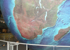
Global grids of synthetic bathymetry make it a simple matter to portray generalised ocean depths in all parts of the world, except the central Arctic Ocean. Derived from measurements of...
This site uses cookies. By continuing to use this website, you agree to our Cookies Policy. Agree