RIEGL Lidar 2012 User Conference
RIEGL USA is to host the RIEGL International Airborne and Mobile User Conference from 28th February to 1st March 2012 in Orlando, USA, at the Hilton Orlando. Attendees will be...
RIEGL USA is to host the RIEGL International Airborne and Mobile User Conference from 28th February to 1st March 2012 in Orlando, USA, at the Hilton Orlando. Attendees will be...
The GeoSpatial Solutions (GSS) division of Merrick & Company has made the new version 6.0 Merrick Advanced Remote Sensing (MARS) software suite available online. Geospatial users interested in evaluating MARS...
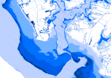
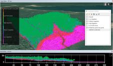
We investigated the most significant issues affecting the creation of a littoral zone digital elevation model from overlapping bathymetric and topographic Lidar (light detection and ranging) data. The main challenge...
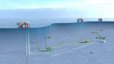
The Norwegian Hydrographic Service (NHS) has and will be utilising airborne LIDAR bathymetry in connection with the ongoing effort to modernise the maritime infrastructure along the Norwegian coast. This article...
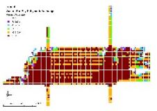
Merrick & Company was awarded a US$345,000 contract to deliver raw and processed LIDAR data, 2-foot contours, and a DEM for 1650 square miles of Stearns County, Minnesota and a...
The remarkable capabilities of airborne Lidar continue to improve, with scanners now able to emit more than a million pulses every second. Although it has never been easier to acquire...
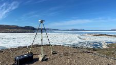
Researchers from the Bureau of Economic Geology have spent the summer in northwestern Greenland conducting research using an airborne Lidar system. The project – Airborne Lidar surveys to quantify Greenland...
A surging interest in remote sensing and analytics has seen technology developments linked to these domains take off over the past couple of years. Airborne Lidar bathymetry (ALB) is no...
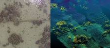
3D at Depth, an expert in commercial subsea Lidar technology and leading provider of underwater survey support services and 3D data solutions, has recently completed a series of 31 metrologies...
Teledyne CARIS has released Bathy DataBASE (BDB) 4.4. This new version addresses the areas of feature generalisation and automation of product generation for chart compilation, as well as the increasing...
This site uses cookies. By continuing to use this website, you agree to our Cookies Policy. Agree