Dutch Flood Defence, the Natural Way
When the Dutch government and research institutions wanted to monitor how waves and currents would affect the pioneering use of artificial sand banks to protect a levee in a non-tidal...
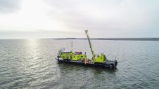
When the Dutch government and research institutions wanted to monitor how waves and currents would affect the pioneering use of artificial sand banks to protect a levee in a non-tidal...
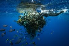
An estimated 600,000 tons of abandoned fishing gear ends up in the oceans every year. According to the United Nations, some 380,000 marine mammals are killed each year, either by ingesting this fishing gear or being caught in it. Mary T. Crowly of the Ocean Voyages Institute describes how GPS trackers are being used to mark the ghost nets. An estimated 600,000 tons of abandoned fishing gear ends up in the oceans every year. According to the United Nations, some 380,000 marine mammals are killed each year, either by...
The UK Hydrographic Office (UKHO) has announced that two ADMIRALTY distributors are now approved providers of ADMIRALTY Vector Chart Service (AVCS) Online, the shore-based version of the maritime chart service....
The United Kingdom Hydrographic Office (UKHO) is to repeat its successful series of free technical seminars at Marintec 2019. The ‘A Future with ECDIS’ sessions will explore the latest developments...
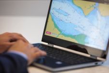
Developed by the UK Hydrographic Office (UKHO), Admiralty Vector Chart Service (AVCS) Online gives shore-based users and planning teams access to more than 15,000 Electronic Navigational Charts (ENCs), updated weekly,...
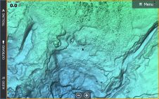
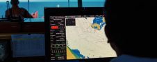
C-MAP, a leader in digital marine cartography and cloud-based mapping has released new C-MAP Reveal charts, featuring views of the seafloor. This cartography offers all the navigation data and capabilities...
From Ocean Business 2019, the international trade show last week in Southampton, UK, Hemisphere GNSS, Inc. (Hemisphere) announced the signing of a strategic distribution agreement with Oceaneering International, Inc. This agreement...
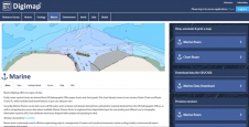
OceanWise’ intelligent marine mapping data is now accessible to students in Further and Higher Education across the British Isles via Digimap, the online map and data delivery service provided by...
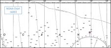
NOAA’s Marine Chart Division (MCD) is currently revising production efforts using an ‘ENC-first’ approach to provide seamless and tiled geographic coverage. Currently, ENC production workflows within MCD require cartographers to...
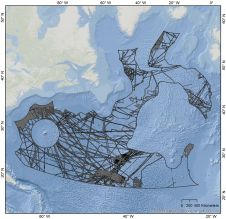
Mapping the world’s oceans is a tremendous task that would benefit from a prioritization strategy. In this article, an in-depth presentation of one such approach is given: GIS-based analysis that...
This site uses cookies. By continuing to use this website, you agree to our Cookies Policy. Agree