Found 507 results
Sort by

Offshore 3D Laser Scanning

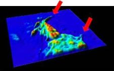
Surveying is benefiting from continually evolving new technologies. One is 3D laser scanning, which is often used for measurements in complex industrial installations such as pipeline-rack crossings or entire petrochemical...

Read more

We Visited for You

The Marine Sandwave and River Dune Dynamics II (MARID) workshop was held in Enschede, The Netherlands on the 1st and 2nd April 2004 The idea to organise workshops dedicated to...

Read more

Science

Decadal Sea Level Trends in the Bay of Biscay from Tide Gauges, GPS and TOPEX Marcos, M., Wöppelmann, G., Bosch, W. and Savcenko, R. 2007. Journal of Marine Systems ,...

Read more

The Naval Oceanographic Office

The Naval Oceanographic Office is proud of the role that it plays within the international hydrographic community. It traces its roots to hydrographic origins: the Depot of Charts and Instruments...

Read more

CoastGIS 2006

The seventh CoastGIS Conference was held at the University of Wollongong, Australia in July. Previous conferences have been held in Ireland, Scotland (twice), France, Canada and Italy. This was the...

Read more

Safe Sailing with Official Nautical Charts

The Norwegian Mapping Authority is the national provider and administrator of geographical and cadastre information covering Norwegian land, coastal and territorial waters. The Norwegian Mapping Authority is a public agency...

Read more

Joining Up Land and Sea

Development of a vertical surface separation model will allow easier assimilation of land and maritime data sources, resulting in seamless vertical data. The future possibilities of having data that can...

Read more