Capturing the Arctic and Antarctic
Capturing and measuring the environment in the Arctic and Antarctic is a particularly challenging job. The area of interest is often covered by a thick blanket of snow and ice,...
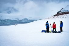
Capturing and measuring the environment in the Arctic and Antarctic is a particularly challenging job. The area of interest is often covered by a thick blanket of snow and ice,...
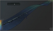
Uncrewed vehicles, both surface and airborne, are increasingly being used for hydrographic surveying. While the technology of data acquisition using these platforms is generally known, the fusion of this data...

A second delivery of Lightweight Autonomous Underwater Vehicle (LAUV) units to the Danish Navy took place in April 2022 in the naval base of Frederikshavn, Denmark. This delivery is part...
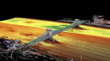
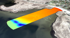
Two Hungarian companies designed a three-step data collection workflow to overcome the challenges in this urban surveying project in Hungary, which included the use of UAVs and remote-controlled boats for...

A first delivery of three small AUV units took place in January 2022 in the naval base of Frederikshavn, Denmark. This delivery is part of the recently signed framework agreement...
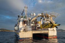
Ifremer, the French research institute for ocean science, has received its new synthetic aperture sonar (SAS) from iXblue. It will equip the institute’s new 6,000m-rated autonomous underwater vehicle (AUV) dedicated...
Ocean Floor Geophysics (OFG) and DOF Subsea (DOF) have entered into a strategic alliance for Autonomous Underwater Vehicle (AUV) services to the global offshore industry. The partnership will effectively leverage...
The practice of identifying and monitoring an area's physical features by measuring its reflected and emitted radiation from a distance is known as remote sensing (typically from satellite or aircraft). Researchers can "sense" facts about the Earth by using special cameras to acquire remotely sensed photos. Remote sensing is a fascinating field that revolves around the acquisition of Earth-related information without direct physical contact. It typically yields either point cloud data or imagery, both of which...
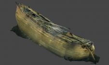
The Finnish dive team Badewanne has helped to complete the documentary Fluit, about the 17th-century Dutch fluyt shipwreck, The Swan, which they discovered at a depth of 85m (279ft) in...
SBG Systems’ popular INS/GNSS PPK software called Qinertia is now available to users of Septentrio AsteRx-i3 D Pro+, AsteRx-i3 S Pro+ and AsteRx SBi3 Pro+ receivers. “As a result of...
This site uses cookies. By continuing to use this website, you agree to our Cookies Policy. Agree