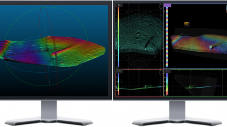
3D Sonar Visualisation Software for ROVs
CodaOctupus, UK, has released version 2 of the Vantage software, a visualisation software suite for the Dimension 3D sonar specifically targeted at ROV-centric applications.
The key new features in Version 2 include:
- new 3D XYZ Binned Profiler Output allows fantastic utility of the Dimension 3D sonar to provide complete profile XYZ data over a selectable slice ahead of the ROV with real-time binning options optimised for seabed surface generation or seabed with vertical features. Similar to the 3D XYZ Data Visual Export feature, incoming navigation is used when available to provide a complete coverage map, when no navigation data is available a waterfall display can still be generated using ping time.
- new 3D XYZ Data Visual Export to file to allow any structures or data seen in the display to a standard XYZ file for further processing, analysis or integration with other data. Where navigation data is provided, absolute coordinate XYZ data will be export, otherwise relative coordinates are generated which can be manually positioned in industry standard point cloud and CAD software.
- enhancements to the processing and display of incoming navigation data with upgrade of the integral Coordinate System Designer to version 1.5 release. This release includes improved support for NADCON-based coordinate reference systems.
- visual enhancements to display data in various formats to better suit worldwide applications.
According to CodaOctopus, these features significantly increase the utility of the Vantage software and CodaOctopus’ Dimension 3D sonar and allow data use beyond that of real-time visualisation. A further feature will be released in the coming weeks extending the Target marking capability with full Way Point tracking and guidance. Targets can be marked in real-time from observations in the 3D data or manually entered from coordinates of known objects of interest. The real-time 3D and range and bearing display allows the ROV pilot to navigate safely to or from these features from a single and seamless interface.


