News
CCGIS Map Gives First Peek at Assets
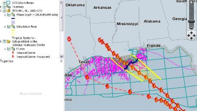
C&C Technologies gives registered users a free means of tracking named storms in relation to their Gulf of Mexico assets in real time during clear weather and throughout storms such as Hurricanes Ike and Gustav with CCGIS Map.
CCGIS Map is a Geographic Information System developed by C & C. It focuses primarily on the oil and gas industry's infrastructure and allows efficient access to real time Gulf of Mexico data to anyone with Internet access.
Users of CCGIS Map do not have to wait until after the storm's passage. National Hurricane Center storm positions are plotted as they become available. You can watch the storm track in real time as it passes over Gulf of Mexico oilfield infrastructure.


