News
Live Hurricane-Tracking Map
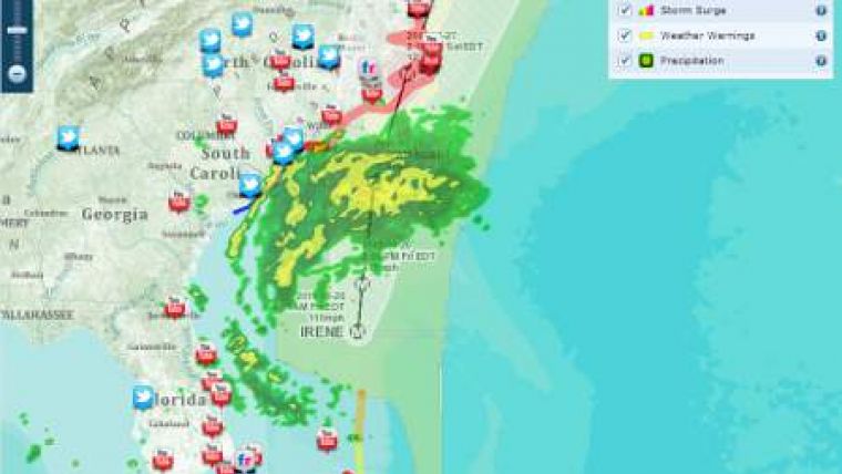
Esri has created a mash-up of the hurricane Irene. The data is displayed close to live and displays various aspects of the weather including storm surges, active hurricanes and precipitation.
Following the tradition of Esri, the interactive map includes tweets marked Irene, Youtube videos and images on Flickr.


