USVs Conduct Underwater Topographic Survey in the Antarctic
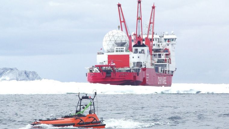
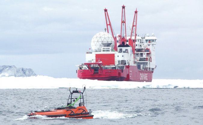
In November 2017, China’s 34th Antarctic scientific expedition was officially launched. Two Oceanalpha M80 submarine exploration unmanned surface vehicles (USVs) and two SE40 hydrographic USVs accompanied the polar scientific research ship ‘Snow Dragon’ all the way south to Inexpressible Island on the west bank of the Ross Sea to assist in the construction of China's fifth Antarctic research station.
Since the Ross Sea area had never been explored before, there was insufficient geographical data, making it difficult to find the ideal anchorage for the Snow Dragon. The USVs contributed to solving that problem by collecting bathymetric and topographic data.
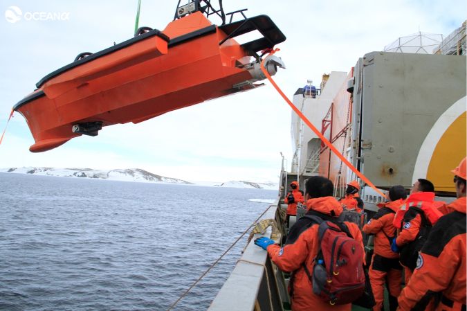
On 24 October 2017, an engineering team from Oceanalpha visited the Chinese Polar Expedition Base in Shanghai to conduct a test for the preparation of the upcoming expedition of the polar-customised M80 USV. After a simple land test, engineers used a small crane on the Snow Dragon to hang the USV into the water.
Subsequently, the M80 USV was tested in terms of communication, control, the lifting mechanism and multibeam survey in the 300m x 500m basement tank, with satisfactory results. Six hours later, the unmanned boat was retrieved by the Snow Dragon’s crane.
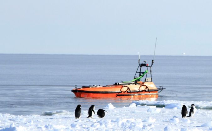
The working situation on Inexpressible Island
On 8 December 2017, four USVs completed the bathymetric and topography multibeam survey of five square kilometres in about 14 hours. The M80 was responsible for scanning the deep-water area, while the smaller ME40 took care of the shallower area near the shore. With the data collected, the USVs filled the data gap in the region and provided geographic information and data support for the construction of the Antarctic expedition station.
Design highlights of the M80 USV
The payloads, structure and working environments of different missions M80 will be participating were fully considered right from the beginning of the R&D phase. As a result, the M80 includes multiple technological design breakthroughs. The trimaran design of the USV achieves excellent performance in terms of stability and wave resistance; the specially designed wave-eliminating bulbous bow not only effectively reduces the vertical sway of the USV, but also helps to reduce the interference of the water splash and bubbles on the hull-mounted acoustic survey equipment, thus supporting better-quality survey data.
The low temperature of the Antarctic could cause changes in the mechanical properties of the hull material, deterioration of the GNSS signal and impact on electronic components. To ensure that the M80 could be qualified for this mission, the team conducted a lot of research and made improvements to the structural strength of the hull, the selection of the power system and the selection of electronic components. In terms of the deck design, the bollard was newly designed to facilitate the capture and stagnation while launching and retrieving the USV. As for the GNSS antenna mount, a turbulent structure is applied on the deck to weaken the multipath effect at sea.
Conclusions
- The M80 USV is capable of working in harsh natural environments. In addition to the severe cold, this Antarctic project also encountered ice floes and strong winds. The USV successfully overcame the above-mentioned difficulties and completed the survey within the specified time, which reduced labour costs and ensured the safety of staff.
- High working efficiency. The USV was launched into the water at the same time as the Snow Dragon was still unloading materials. The operator sent the pre-set measurement task from the Snow Dragon to the USV, and the USV began to survey. The USV took 14 hours to automatically complete the multibeam full-cover seabed topographic survey of five square kilometres, utilising minimum human and material resources. In the future, if multiple USVs work together, the survey efficiency could be further improved.
- Reduced energy consumption. The use of USVs for surveys consumes only one-tenth of the energy of manned vessels. This saves substantial fuel costs for the ocean-going mother ship, while valuable loads can be attributed to other materials.