Autonomous Research Vehicle Completes Ocean Crossing from San Francisco to Hawaii
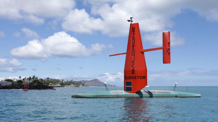
The uncrewed, autonomous Saildrone Surveyor has arrived in Hawaii after a groundbreaking maiden voyage from San Francisco to Honolulu. While ocean crossings are nothing new for Saildrone’s autonomous surface vehicles, the Saildrone Surveyor is a new, much larger class of vehicle that is optimized for deep-ocean mapping. During the 28-day voyage, the Saildrone Surveyor sailed 2,250 nautical miles and mapped 6,400 square nautical miles of seafloor.
Using renewable wind and solar energy for its primary power source, the Saildrone Surveyor is the only vehicle in the world that is capable of long-endurance, uncrewed ocean mapping operations. The valuable data that it collects will help to address some of the issues impacting our world, including climate change, offshore renewable energy, natural resource management and maritime safety.
Array of Acoustic Instruments
Measuring 72 feet long (22m) and weighing 14 tons, the Saildrone Surveyor carries a sophisticated array of acoustic instruments that is normally only carried by large, manned survey ships. The Surveyor’s sensors interrogate the water column, looking at underwater ecosystems and mapping the seafloor in high resolution to a depth of 23,000 feet (7,000m).
Multibeam data from the Saildrone Surveyor has been calibrated and assessed by an external team from the University of New Hampshire (UNH), which normally calibrates large government survey vessels. “The data quality from the Surveyor is of very high quality; as good as anything we have seen from a ship,” said Larry Mayer, director of the UNH Center for Coastal and Ocean Mapping (CCOM). “Due to the wind-powered nature of the vehicle, it is very quiet, and this enables the very accurate acoustic measurements needed to map to these depths.”
Changing the Ability to Understand our Planet
The ocean covers more than 70% of the planet, but over 80% of the ocean remains unmapped and unexplored. The lack of ocean exploration is largely due to the high cost of access to our oceans, which has traditionally been undertaken by large ships. These ships can cost hundreds of millions of dollars to build and hundreds of thousands of dollars per day to operate. The Saildrone Surveyor represents a paradigm shift in the cost of ocean access, performing the same job as a survey ship but at a fraction of the cost and carbon footprint.
“This successful maiden voyage marks a revolution in our ability to understand our planet,” said Richard Jenkins, Saildrone founder and CEO. “We have solved the challenge of reliable long-range, large-payload remote maritime operations. Offshore surveying can now be accomplished without a large ship and crew; this completely changes operational economics for our customers. Based on this achievement, I am excited to apply Saildrone Surveyor technology to other markets normally reserved for large ships, such as homeland security and defence applications. The implications of a low-carbon solution to these critical maritime missions are significant.”
With this successful proof of concept voyage, Saildrone, Inc. of California will now build a fleet of Surveyors to be manufactured at U.S. shipyards. Saildrone intends to map the entire earth’s oceans in the next 10 years.


