AUV Surveys Deep off Pacific Northwest
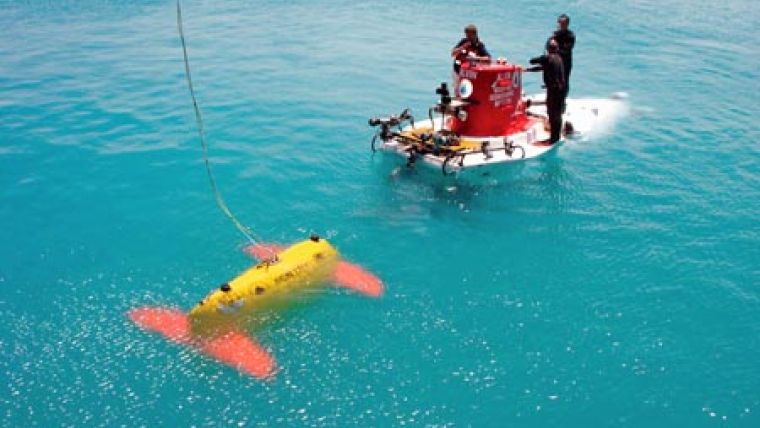
Scientists and engineers from the Woods Hole Oceanographic Institution (WHOI) and the University of Washington (UW) have successfully completed the first scientific mission with Sentry, a newly developed robot capable of diving as deep as 5,000 metres into the ocean.
The vehicle surveyed and helped pinpoint several proposed deep-water sites for seafloor instruments that will be deployed in the National Science Foundation's (NSF) Ocean Observatories Initiative (OOI).
The AUV Sentry is pre-programmed with guidance for deep-water surveying, but it can also make its own decisions about navigation on the mountainous volcanic terrain of the seafloor.
Working in tandem with sonar instruments on the UW-operated research vessel Thomas G. Thompson and with photo-mapping by WHOI's TowCam seafloor imaging system, Sentry gathered the most precise maps to date of seafloor features known as Hydrate Ridge and Axial Volcano, around the edges of the Juan de Fuca tectonic plate off the coast of Oregon and Washington. Two nodes of a pioneering deep-ocean observatory are being planned for those locations.
The one-of-a-kind, WHOI-built AUV made six dives during the 22nd July 22 to 5th August expedition. Sentry surveyed 212 linear kilometres of seafloor, or about 53 square kilometres, as it traced parallel lines like a lawn-mower making a pattern across a yard."
The AUV can collect the data needed to make seafloor maps at a resolution of less than one metre. On this first cruise, Sentry collected as many as 60 million individual soundings of seafloor depth in a single dive.
Powered by more than 1,000 lithium-ion batteries-similar to those used in laptop computers, though adapted for extreme pressures-Sentry dove for as long as 18 hours and 58 kilometres, with the potential for longer trips in the future.
Sentry is designed to swim like a fish or fly like a helicopter through the water. The sleek hydrodynamic design allows the vehicle to descend quickly from the sea surface to the depths (about 3,500 metres per hour). The novel shape also gives the vehicle tremendous stability and balance while cruising through bottom currents.
The vehicle has thrusters built into its foils, or wings. Like an airplane, the foils allow the vehicle to gain lift or drag or directional momentum, as needed. When necessary, the AUV also can hover over the bottom for close-up inspections, navigational decision-making, and for rising up and down over rugged seafloor terrain. The design allows the vehicle to start, stop, and change directions, whereas many AUVs tend to travel in one direction.
The AUV tracks its motion over the seafloor using a sophisticated inertial navigation system (INS), long-baseline (LBL) navigation triangulated from underwater beacons and, when within 200 metres of the bottom, an acoustic sensor can track the vehicles' direction and speed with great precision.
On its first scientific mission this week, Sentry carried a multibeam mapping sonar, a water conductivity and temperature (CTD) probe, an optical backscatter sensor (to detect cloudy water), two magnetometers, and a sensor for detecting water chemistry related to hydrothermal vents, in collaboration with Ko-Ichi Nakamura of Japan's National Institute of Advanced Industrial Science and Technology.


