Bedrock Launches Ocean Exploration and Survey Platform
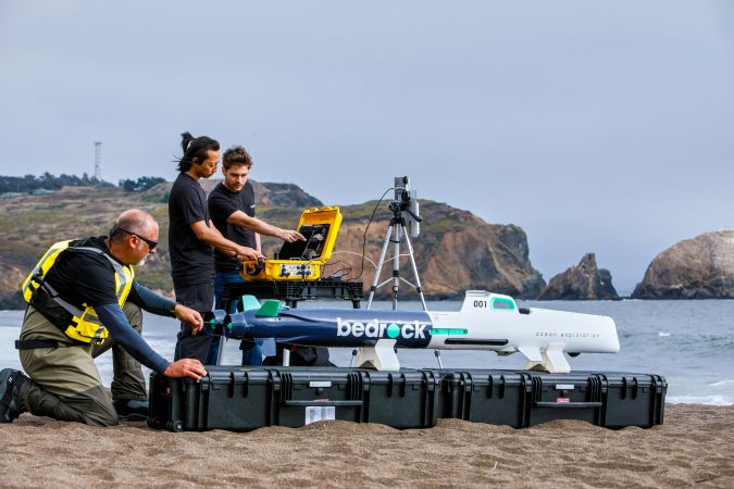
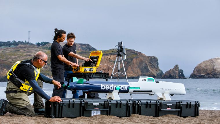
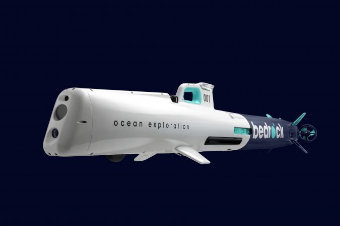
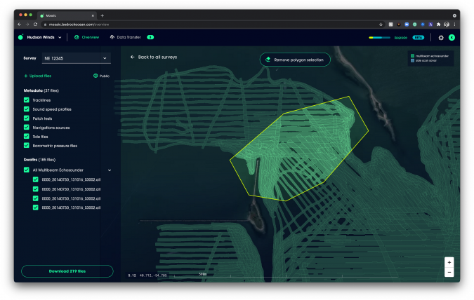
Bedrock, a vertically-integrated sea-floor data platform and service, has announced the launch of its full-service offering: autonomous ocean surveys powered by the company’s proprietary, 100% electric autonomous underwater vehicle (AUV) and Mosaic, a universal cloud-based survey data platform for managing, accessing and sharing any marine survey data from any ongoing or historical survey, which is now open for beta sign-ups.
Currently, the turnaround time of ocean-floor maps is up to 12 months per survey to provide customers with usable commercial sea-floor data. Bedrock’s two modern technologically-enabled services work together to accelerate commercial wind development cycles, providing survey status and data immediately – up to 10 times faster than the current solution, the company claims.
With extreme weather incidents becoming increasingly common due to climate change, countries worldwide are looking for solutions to mitigate their devastating effects. Initiatives range from imposing carbon taxes and emissions limits to ambitious green energy transition plans like President Biden’s 2,000 wind turbine goal by 2030 and multilateral agreements such as the Paris Climate Accords.
Increasing the Efficiency of Sea-floor Data Acquisition
Anthony DiMare, CEO and co-founder, and former SpaceX and Submarine engineer Charles Chiau, CTO and co-founder, started Bedrock to accelerate the rate and scale with which humans can map, understand and use the ocean, which are ultimately needed for rapid implementation of green and marine technology such as offshore wind energy to fight climate change and drive planet-saving innovation for generations to come.
“The ocean is a key environment that we need to deeply understand to save the planet from climate change and provide sustainable, renewable energy,” said Anthony DiMare, co-founder and CEO of Bedrock. “But right now, we simply don’t have the ability to act quickly because we lack simple, easy access to critical data on how the ocean works, starting with the sea floor. Bedrock’s vertically-integrated sea-floor data platform enabled by our proprietary AUVs, coupled with Mosaic, is the technology needed for this new function shift to change the way we work with our oceans.”
The company’s fully electric AUVs allow Bedrock to improve the speed and efficiency of sea-floor acquisition and mapping, which according to the company results in – in some circumstances –delivering data that has an up to 50 times higher resolution than the best publicly available maps. It geophysically maps the ocean floor in high resolution without the need for large survey ships, accelerating the rate and increasing the efficiency of sea-floor data acquisition.
Sharing Marine Survey Data
Mosaic, the company’s data platform, is presented as Bedrock’s groundbreaking step forward for the entire sea-floor data ecosystem. The platform’s beta waitlist provides all owners, users and managers with access to sea-floor data, enabling them to efficiently share marine survey data. It is agnostic to the data acquirer, meaning that anyone who processes sea-floor data can have a centralized place to store and work with their data.
“In order to understand the state of the ocean, we need a baseline set of measurable metrics. Bedrock collects the needed data to drive proactive actions in areas of strategic impact for progress and prevention, rather than just being reactive,” said Charlie Chiau, CTO and co-founder of Bedrock. “Our platform’s first and immediate application is to accelerate offshore renewable energy projects, which now need this ability for faster and repeatable discovery and monitoring of sea-floor health and status.”
Within its current services, Bedrock is launching a free tier of 50GB of private sea-floor data storage, which enables anyone with an internet connection to publish survey data to the free, public ocean dataset, as well as easily download anything already within it. Bedrock’s goal with this is to encourage the public to contribute any obtained marine data to the public map, in the simplest way possible.
With Bedrock’s AUV-based survey approach coupled with Mosaic, ocean-floor surveys – which are required for a myriad of critical infrastructure projects including the development, installation and maintenance of every new offshore wind turbine – can be done faster, more efficiently and significantly more environmentally friendly than ever before, the company states.