Californian Seafloor Mapping Reveals Hidden Treasures
Three products in an ongoing series have been released by the U.S. Geological Survey: a map set for the area offshore of Carpinteria, California, USA, a catalogue of data layers for geographic information systems, and a collection of videos and photos of the seafloor in state waters along the entire Californian shoreline. They contain new imagery, new and specialised undersea maps as well as more data.
The USGS is a key partner in the California Seafloor Mapping Program, a historically ambitious collaboration between state and federal agencies, academia, and the private sector to create a comprehensive base-map series for all of California’s ocean waters. Scientists are collecting sonar data, video and photographic imagery, seismic surveys, and bottom-sediment data to create a series of maps of seafloor bathymetry, habitats, geology, and more, in order to inform coastal managers and planners, government entities, and researchers. With the new maps, decision makers and elected officials can better design and monitor marine reserves, evaluate ocean energy potential, understand ecosystem dynamics, recognize earthquake and tsunami hazards, regulate offshore development, and improve maritime safety.
Map Series
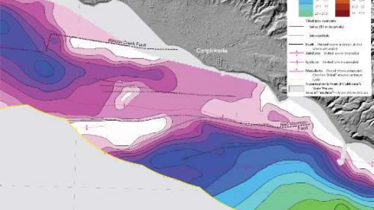
The heart of the USGS California Seafloor Mapping Program effort is a series of map sets. To date, three sets have been published, including the most recent one released today covering the area “Offshore of Carpinteria,” USGS Scientific Investigations Map 3261. Each of the map sets includes 10 or more sheets, illustrating different features of the seafloor, including geology, bathymetry, habitats, and geology within the three-nautical-mile limit of California’s state waters. The maps are created through the collection, integration, interpretation, and visualization of swath sonar data, acoustic backscatter, seafloor video, seafloor photography, high-resolution seismic-reflection profiles, and bottom-sediment sampling data. Fourteen other map sets are being formatted for publication; the California State Waters Map Series is planned to comprise 83 such seafloor map sets spanning the entire coast of California.
Data Catalog
Underlying the series of published seafloor map sets are large geospatial digital files, including bathymetry, acoustic backscatter, offshore geology and geomorphology, faults, folds, potential marine habitats, seafloor character, sediment thickness, visual observations of bottom habitat from video, and more. These data sets are now available through a new California State Waters Map Series Data Catalog for users to create their own maps or engage in further investigations of the seafloor. The catalog, USGS Data Series 781, provides all GIS data layers associated with the map sets published by the California Seafloor Mapping Program. Data will be continually added to the data series catalogue as new seafloor map sets are published. All data files can be viewed and downloaded at no charge. As the California Seafloor Mapping Program continues to produce new maps, they – and all the background data – will be made available online.
Video & Photo Portal
The unique set of seafloor images (video and still photography) collected by the USGS from the U.S.-Mexico border to the Oregon state line is now available via a new California Seafloor Mapping Program Video and Photograph Portal. More than 500 hours of video and 87,000 photographs were collected and are now posted in the online portal for viewing. Scientists are using these data to ground-truth their interpretations of sonar data, to provide a framework for understanding seafloor ecosystems, and to create maps of seafloor materials and habitats. The video and photo portal is based on an interactive map, allowing users to zoom into a particular area, and see the imagery available. The video and still photographs of the same locations are displayed simultaneously, just as they were acquired along the track-line.
The California Seafloor Mapping Program is a unique collaborative effort supported by the USGS, the California Ocean Protection Council, NOAA, California State University at Monterey Bay, and many other academic, government and industry partners.


