Detecting shipwrecks in waters all around the world
Wreck search is a special application of hydrographic surveying. Countless sunken ships – or what’s left of them – have been discovered over the years, often by means of a combined survey with multibeam and sidescan sonar. AUVs and ROVs are also used for underwater survey missions, such as detecting and mapping submerged wrecks. We have selected a series of articles that immerse you in the world of discovering shipwrecks in seas across the globe.
Search for the Ravenel wreck in Saint-Pierre-et-Miquelon
A research campaign that aims to find the wreck of the Ravenel fishing trawler, which disappeared in January 1962 off the coast of Saint-Pierre-et-Miquelon (France), began on 23 May 2021. Despite several attempts over the past decades, the wreck remains unfound. Thanks to the use of the DriX Unmanned Surface Vessel (USV), designed, developed and operated by iXblue, this new research campaign will use unprecedented technological capacity to solve the mystery surrounding one of the most important shipwrecks in the history of French fishing.
Mapping and monitoring the wreck of La Surveillante
Ongoing collaboration between INFOMAR and the National Monuments Service continues to produce exciting results on Ireland’s underwater cultural heritage. Last autumn, the Geological Survey Ireland’s RV Keary resurveyed the 1797 wreck of the French frigate La Surveillante in the course of its 2020 INFOMAR operations along the south-west coast.
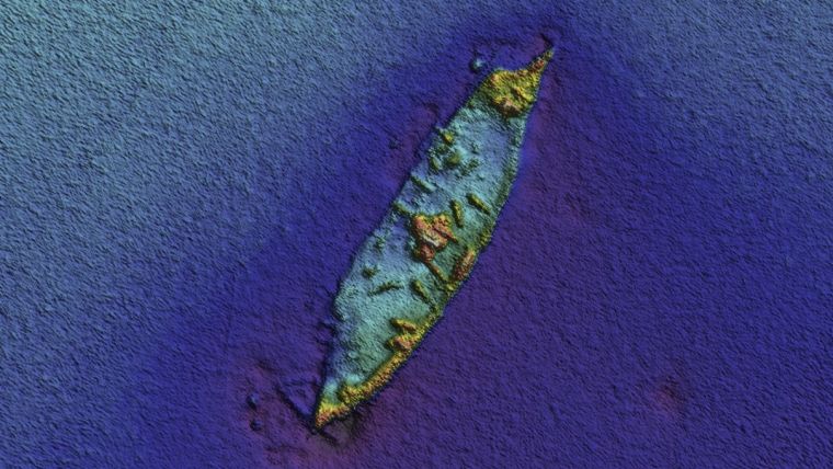
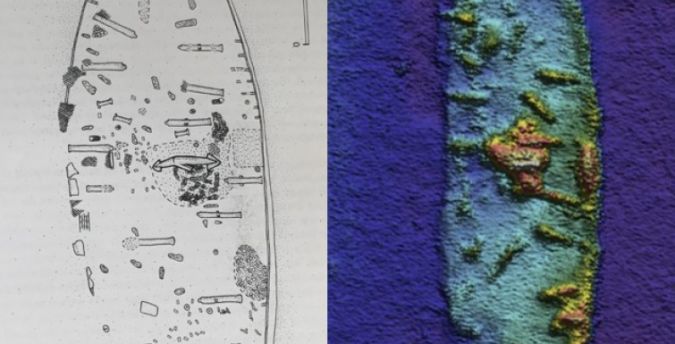
Automatic shipwreck detection in bathymetry data
Archaeologists have long been interested in shipwrecks. These sites can tell us about ancient transportation and trading routes, technological innovations and cultural exchanges over thousands of years. Documenting shipwrecks can be a difficult task, however. With breakthroughs in remote sensing technology (specifically sonar and radar), researchers have been able to acquire highly resolved maps of ocean floors. Consequently, we can also locate cultural objects – like shipwrecks – sitting on the bottom of oceans, lakes and other bodies of water.
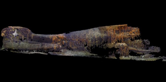
How robotic technology officially identified the World War II submarine S-28 gravesite
After 75 years, and using advanced imaging technology, ocean explorer Tim Taylor and his Lost 52 Expedition Team have officially discovered the final resting place of the 49 sailors of the U.S. submarine S-28 (SS-133) off Oahu, Hawaii. The U.S. Navy recently validated the identity of the wreck, which Taylor located in 2017.
Surveying the wrecks of the Battle of the Atlantic
After years of research, the U.S. National Oceanic and Atmospheric Administration (NOAA) discovered two World War II shipwrecks in 2014 off the coast of North Carolina in the Monitor National Marine Sanctuary. The wrecks form the remains of the KS-520 convoy attack, as part of the Battle of the Atlantic. 2G Robotics modelled these wrecks using EIVA NaviSuite software, once they had been surveyed from a Triton submersible equipped with a Sonardyne acoustically aided inertial navigation system (AAINS) and scanned by 2G Robotics’ laser scanner.