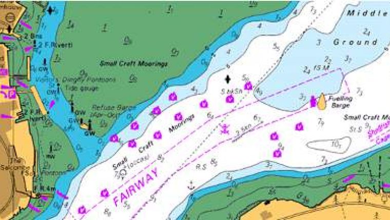
Digitised and Georeferenced Paper Charts
Seazone Solutions, UK, has launched SeaZone HydroView Charts. HydroView Charts have been created from digitised and georeferenced paper charts for GIS display, human interpretation and contextual mapping.
SeaZone HydroView Charts offer full global coverage. These raster map layers are available for immediate use in Geographic Information Systems for a range of applications, without the need for additional software, add-ons or plug-ins, resulting in gains in time and performance.
HydroView Charts provide backdrop mapping for a variety of applications from desktop to internet. HydroView can be also combined with datasets of the user to make the display and dissemination of maps within reports or over the internet simple and effective.
Keiran Millard, group manager of SeaZone, believes that its customers are very familiar with traditional navigation charts. The HydroView product range provides electronic versions of these charts and also prepares for the new range of products designed for where marine data needs to be used for display rather than for spatial analysis.


