Entry-level Hydrographic Surveys Benefit from Software Features for Autonomy
Autonomous operations – in particular automation and remote control – can help achieve low-carbon hydrographic operations while saving time and costs. However, the advanced software features needed to achieve autonomy are typically not affordable for entry-level hydrographic surveys. This is set to change, however, thanks to a newly released software variant.
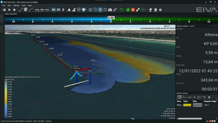
EIVA has released NaviSuite Kuda Core, an entry-level variant of its advanced hydrographic survey software solution. This variant is tailored to surveys with a single USV or small survey vessel using a multi-beam echosounder (including backscatter), Lidar and/or a camera – by providing a simplified user interface so it is easy to configure and run from a single display.
Automatic and Remote Surveys
Using NaviSuite Kuda, operations can be remotely controlled from the office. All that is needed is to connect the software to the USV or manned vessel’s autopilot, and it will steer the vessel. Users can monitor the mission, change settings, change routes/runlines and process data in real time – all from NaviSuite Kuda’s intuitive interface.
The software suite also makes it possible to improve coverage during surveys in real time – with the Coverage Assist tool. This advanced tool takes into consideration how factors such as the weather influence coverage. It plans runlines in real time during the survey, based on the previous surveyed line and the optimal route for turning.

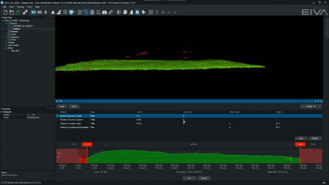
Save Time With Automatic Data Cleaning
Removing noise from the data can be a tedious task, but EIVA’s automatic data cleaning tool, EC-3D, automates the process to clean data as efficiently as possible. Not only does the tool provide a variety of cleaning methods, but these can also be combined in customizable configurations. These configurations can then be saved and loaded for use on different datasets from a survey.
Add Automatic Data Processing to the Survey Software
A number of variants are available to process the survey data. Advanced data processing tools include backscatter and sidescan mosaicking, GPS height processing, volume and difference calculation, and export to GIS. Using the advanced processing variants not only provides a wide variety of processing tools, but also a workflow automation tool. It is possible to save time and avoid carrying out menial tasks using NaviSuite Workflow Manager to automate the data processing workflow. This tool can also be used to enable autonomous operations through automatic onboard processing.
Software Scales Up With the Survey Setup
The extensive list of advanced features in the NaviSuite software family also means that if users scale up operations, the software easily scales up with them. For example, operations may start on a single vessel then move to a large vessel with remotes and a subsea vessel. Users can start small and grow, using the same software!
For further information, please feel free to contact the EIVA crew.