Nigerian Navy joins global mission to map the ocean floor
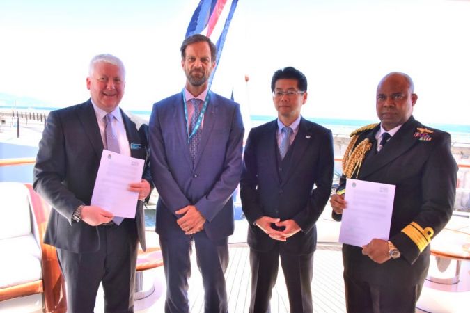
The Nippon Foundation-GEBCO Seabed 2030 Project has announced a new partnership with the Nigerian Navy to support its mission. The two parties have entered into a memorandum of understanding, committing to collaborative work to obtain the most extensive dataset of the world’s seabed by the end of the decade.
The announcement took place on board the 65-metre MV White Rose of Drachs, which is currently docked at the Port of Cap d’Ail, on the border between France and the principality of Monaco. This strategic location adds significance to the event. The Nigerian Navy, recognized as one of the largest navies on the African continent, brings valuable expertise and resources to this important initiative. In addition to their defence services, the navy serves as the sole national authority on hydrographic, charting and tidal matters. With the potential involvement of up to 20 vessels from the Nigerian fleet, the country’s participation in the Seabed 2030 project will substantially expand its reach and drive significant progress towards achieving its vital goal.
Seabed 2030, a collaborative project between The Nippon Foundation and GEBCO, aims to inspire the complete mapping of the world’s ocean by 2030 and compile all bathymetric data into the freely available GEBCO Ocean Map. It is also a formally endorsed Decade Action of the UN Ocean Decade. GEBCO, a joint programme of the International Hydrographic Organization (IHO) and the Intergovernmental Oceanographic Commission (IOC), is the only organization mandated to map the entire ocean floor.
First collaboration of its kind
This partnership is a significant milestone for Seabed 2030 as it represents the first collaboration of its kind in Africa. The signing ceremony took place during the 3rd Session of the IHO Assembly, which brought together representatives from 98 Member States and observers to discuss new developments in ocean mapping and technical standards.
“We are delighted to welcome the Nigerian Navy to our esteemed network of partners,” said Jamie McMichael-Phillips, Seabed 2030 project director. “The Navy’s expertise and resources greatly enhance our data collection capabilities. Together, we can advance our understanding of the ocean floor and pave the way for a more sustainable future.”
Rear Admiral Chukwuemeka Ebenezer Okafor of the Nigerian Navy expressed his satisfaction with the partnership, stating: “The Nigerian Navy is pleased to partner with Seabed 2030 on this ambitious mission. We have a wealth of experience in oceanographic research and survey operations and look forward to contributing to this global effort to better understand, and ultimately protect, the ocean.”
This partnership follows the recent announcement of the 2023 GEBCO grid figure, which revealed that a quarter of the entire seabed has now been mapped. It demonstrates Seabed 2030’s commitment to expanding its global network of partners and mobilizing the international community to support its ambitious goal before 2030.
All data collected and shared with the Seabed 2030 project is included in the free and publicly available GEBCO global grid.