Royal Navy Tests Groundbreaking Software to Rapidly Map the Seabed
The British Royal Navy has tested cutting-edge software to map the seabed close to shore in hours – not days or weeks. Survey vessel HMS Magpie was able to chart the waters around Plymouth purely using regular radar installed on shipping the world over and a specialist computer programme which measures wave height.
Using that data and information about currents, the software can produce a detailed profile of the seabed in a matter of hours – without the ship or boat having to physically sail over the area being surveyed.
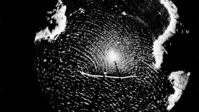
Radar Bathymetry
All the system needs is wind and a swell to generate waves – plus computing power. It is not as detailed as the scans that Magpie or other Royal Navy survey vessels can produce with their hi-tech sonar suites – and it only works close to shore.
However, the method – known as radar bathymetry and developed by scientists from the National Oceanography Centre in Liverpool and MOD experts from the Defence Science and Technology Laboratory – could be vital in times of peace or war when time is critical.
“By analysing the sea clutter images of waves visible on standard marine radars, a bathymetric profile (the depth) and surface current assessment is created,” explained the lead project scientist at the National Oceanography Centre, Paul Bell.
“This technique could allow the remote charting of both shallow water and currents from a standoff distance of several nautical miles and could be employed by all Royal Navy ships using the navigation radars that are already fitted.”


