Seabed 2030 strengthened by ARGANS dataset contribution
ARGANS, a leading Earth observation company, has contributed a significant dataset of 8,000 square kilometres to The Nippon Foundation-GEBCO Seabed 2030 Project – the project seeking to inspire the complete mapping of the entire ocean floor by 2030. This contribution was made possible thanks to the European Space Agency (ESA), which supported projects leading to the generation of satellite-derived bathymetry.
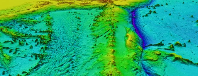
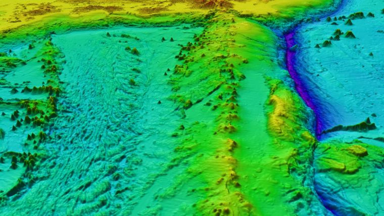
The notable data contributed by ARGANS covers an area of 8,000 square kilometres in regions that conventional ocean vessels typically cannot reach. Using cutting-edge satellite-based remote sensing technologies, ARGANS collected high-resolution bathymetric data in these remote and challenging areas, filling critical gaps in Seabed 2030’s mapping database.
Seabed 2030 is a collaborative project between The Nippon Foundation and GEBCO to inspire the complete mapping of the world’s ocean by 2030 and to compile all bathymetric data into the freely available GEBCO Ocean Map – it is also a formally endorsed Decade Action of the UN Ocean Decade. GEBCO is a joint programme of the International Hydrographic Organization (IHO) and the Intergovernmental Oceanographic Commission (IOC) and is the only organization with a mandate to map the entire ocean floor.
Earth observation and remote sensing applications
Based in the UK, ARGANS is a specialist company committed to environmental stewardship and technological innovation. The company offers services in earth observation, remote sensing applications and geographical information systems used to map and monitor the marine, atmospheric and terrestrial environments.
“The ability of the team here at ARGANS to pioneer cutting-edge developments in satellite-derived bathymetry techniques has been empowered through collaborative grants and contracts with ESA and the French hydrographic agency SHOM,” said Martin Jones, coastal programme manager at ARGANS. “This enables us to deliver valuable data in previously unmapped regions, marking a significant leap in our capabilities.
“Understanding the seabed’s topography is crucial for numerous sectors, including marine conservation, resource management and disaster prevention. By supporting this initiative, we hope to foster global collaboration and contribute to the sustainable future of the ocean.”
Seabed 2030 project director Jamie McMichael-Phillips said: “The data donated by ARGANS will help us fill critical knowledge gaps, providing unprecedented detail about the ocean floor’s structure. Such information is fundamental for understanding climate change impacts, identifying potential marine habitats and safeguarding the future of the ocean.”
All data collected and shared with the Seabed 2030 project is included in the free and publicly available GEBCO global grid.