News
StarFish v2.0
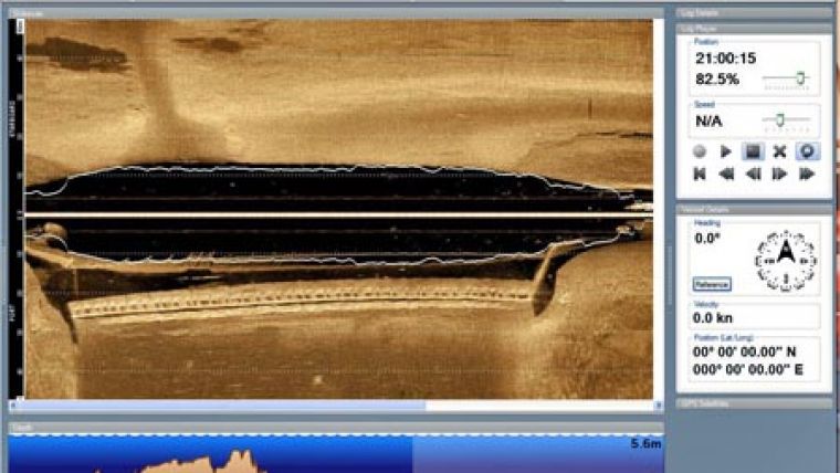
Tritech International Ltd announce the launch of the new StarFish, Scanline V2.0 Software. StarFish is a side-scan sonar which produces images of the seabed and has improved capabilities. Tritech are offering a free upgrade of the StarFish Scanline V2.0 Software.
New StarFish Scanline V2.0 Software features:
- New log file format - Allows storage of sensor and environmental parameters. Log files created using Scanline V1.1 will be converted to the new format when they are opened.
- Redesign of the user interface - matching the Microsoft Office style ribbon interface.
- Hardware management system improvements - New automatic connection system; improving the way external USB and serial (NMEA) devices are detected and connected.
- Configuration wizard
- Depth plotter
- Data manager - widget to help select which types of data are to be used from the attached sensors.
- GPS constellation viewer - Showing current satellites in use, signal strengths and details of the current fix being taken.
- Support of UTM coordinates.
- Redesign of data plotters - allowing interaction with GPS position and depth information beneath the cursor.
Utilising advanced digital CHIRP acoustic technology, developed from the professional underwater survey industry, StarFish can view targets at longer ranges without any loss in image quality.


