Submerged Aquatic Vegetation Mapping
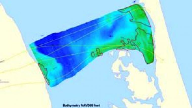
In July 2007, a hydrographic survey team from Duck (NC, USA) mapped 6.7 square miles of the Currituck Sound in water depths of less than 3m. The aim was to chart the depth and identify areas of submerged aquatic vegetation (SAV) around the proposed corridor routes for the mid-Currituck Bridge. The team used a pontoon boat equipped with a GeoSwath Wide Swath Sonar along with bottom grab samples to produce a bathymetric map and identify a total of 1.31 square miles of Submerged Aquatic Vegetation (SAV).
Hypack survey software was used to navigate the boat along pre-programmed survey lines and to log the position data. The GeoSwath depth and backscatter amplitude data was processed using the Geo-Swath Plus software to produce the bathymetry digital elevation models and side scan mosaics.
The GeoSwath data was further processed using GeoAcoustics' GeoTexture software. This normalises the amplitude returns, improves the interpretability of the texture information in the image, and allows the classification of the different bottom types. Swaths from individual days were merged to create a mosaic of the entire survey area which was then exported as geo-referenced side scan image files for analysis in GIS.


