Successful Tests VTOL Unmanned Air System
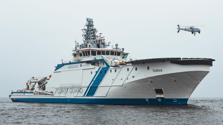
Schiebel’s Camcopter S-100 Vertical Takeoff and Landing (VTOL) Unmanned Air System (UAS) performed a five-day maritime surveillance demonstration aboard Offshore Patrol Vessel (OPV) Turva. The flight trials by the Border and Coast Guard Division of the Finnish Border Guard took place at the end of August in the Gulf of Finland. Day and night, the S-100 completed given scenarios including searching, locating and recognizing objects as well as surveillance for maximum situational awareness.
The Camcopter S-100 was selected for the shipboard trials because of its proven and reliable UAS for intelligence, surveillance and reconnaissance (ISR) missions, the Austrian company states. The S-100, a compact unmanned helicopter, offers a high degree of versatility and is well known to accommodate a wide variety of innovative and market-leading payloads, tailored to meet customers’ specific requirements.
To comply with its assigned tasks, the S-100 was equipped with the L3Harris Wescam MX-10 Electro-Optical/Infra-Red (EO/IR) camera, the Overwatch Imaging PT-8 Oceanwatch wide-area maritime surveillance payload and an Automatic Identification System (AIS) receiver.
No Prepared Area or Supporting Equipment to Enable Launch
Schiebel Group, an Austrian company, focuses on the development, testing and production of mine detection. The Vertical Takeoff and Landing (VTOL) UAS requires no prepared area or supporting equipment to enable launch and recovery. It operates by day and by night, under adverse weather conditions, with a beyond line-of-sight capability up to 200 km / 108 nm, over land and sea.
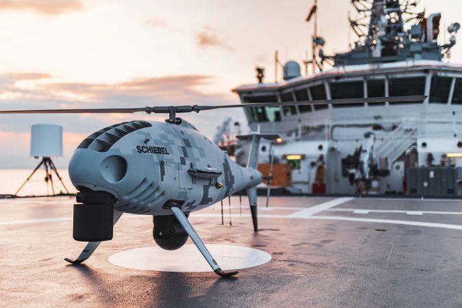
Its carbon fibre and titanium fuselage provide capacity for a wide range of payload/endurance combinations up to a service ceiling of 5,500 m / 18,000 ft. In a typical configuration, the Camcopter S-100 carries a 34-kg / 75-lbs payload up to 10 hours and is powered with AVGas or JP-5 heavy fuel. High-definition payload imagery is transmitted to the control station in real-time. In addition to its standard GPS waypoint or manual navigation, the S-100 can successfully operate in environments where GPS is not available, with missions planned and controlled via a simple point-and-click graphical user interface.


