Taking Bathymetry Using a Kayak
As a geomatics professional and avid kayaker involved in training, consulting and supporting CARIS bathymetric processing software, Matthew Gudger decided to assemble a simple and easy-to-use kayak-mounted bathymetric mapping system which could help to create simple bottom terrain maps of local lakes. The original concept was conceived by Paul Illsley, a geomatics instructor based in Nova Scotia, Canada.
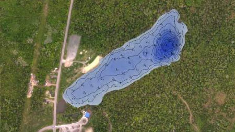
A bathymetric survey was conducted of Killarney Lake in Fredericton, New Brunswick. The survey was completed using a prototype sounding system consisting of a 10-foot open-cockpit kayak, Humminbird 788ci HD depth sounder and a 12V power supply. A series of 2,100 soundings were collected during the two-hour survey which were used in the creation of a depth model and selected soundings for the lake. The data was imported and processed using CARIS BASE Editor.
CARIS customer service representative Matthew plans to continue mapping lakes in the area in the future and share his passion for geomatics with the local community.


