UNH Oceanographer to Lead National Oil Spill Committee
A University of New Hampshire ocean mapping expert will lead the National Research Council’s committee to study the effects of the Deepwater Horizon oil spill on ecosystem services in the Gulf of Mexico. Larry Mayer, professor of Earth science and ocean engineering, director of UNH’s Center for Coastal and Ocean Mapping, and co-director of the UNH-NOAA Joint Hydrographic Center, will chair the committee in a 30-month inquiry that will produce a final report for elected officials, public policy leaders, and the public in fall of 2012.
The 16-member committee is charged with evaluating the loss of ecosystem services in the Gulf of Mexico Large Marine Ecosystem due to the Deepwater Horizon spill.
“The committee is looking at approaches to evaluating the impact of the spill on ecosystem services,” says Mayer, who returned from the first committee meeting last week. “What techniques are available to quantify the impact of the spill on food from the Gulf, how do you determine the impact on water purification, or recreation or cultural significance?”
An interim report, anticipated for summer of 2011, and the final report will provide a framework to assist federal agencies and others in assessing the effects of the oil spill on ecosystem services within the context of other human activities. Under the auspices of the National Academy of Sciences, the National Research Council is an independent, unbiased institution that aims to provide elected leaders, policy makers, and the public with expert advice based on sound scientific evidence.
Mayer, whose primary research concerns ocean mapping and sonar imaging, worked in the Gulf of Mexico on the NOAA ship Thomas Jefferson after the spill. But he stresses that as the chair, he relies on the individual expertise of committee members.
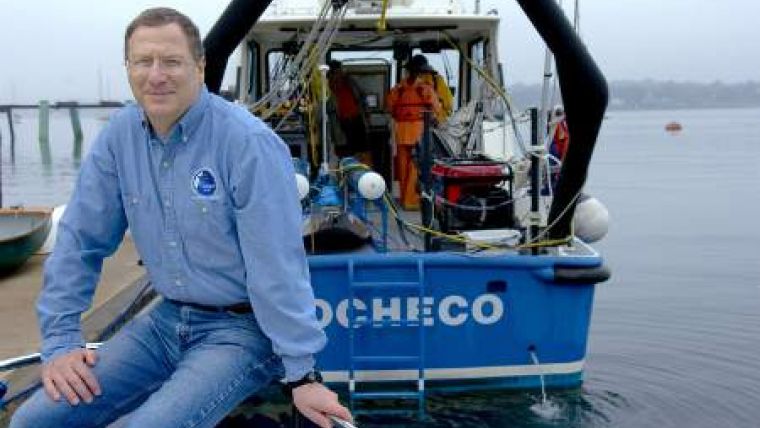
Image: Larry Mayer, University of New Hampshire professor of Earth science and ocean engineering, director of UNH’s Center for Coastal and Ocean Mapping, and co-director of the UNH-NOAA Joint Hydrographic Center. Image Courtesy: Lisa Nugent, UNH Photographic Services


