Woolpert leads Florida seafloor mapping for coastal protection
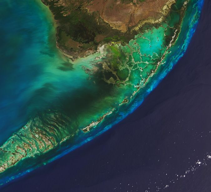
The Florida Department of Environmental Protection has commissioned Woolpert to acquire bathymetric survey data using Lidar technologies to support the Florida Seafloor Mapping Initiative (FSMI) and its mission to produce a comprehensive, publicly available, high-resolution seafloor surface model of Florida’s coastal waters by 2026.
FSMI builds on the efforts of the Florida Coastal Mapping Program (FCMaP), an initiative led by federal and Florida state agencies and other community stakeholders to facilitate the collection of approximately 171,780 square kilometres of high-resolution coastal seafloor data from Florida’s shoreline to the continental shelf.
Two phases: Lidar and sonar
Once completed, the FSMI dataset is expected to be merged with existing terrestrial Lidar. The data will be used by federal and Florida state agencies to help better understand the state’s coastal vulnerability and hurricane impacts, evaluate the performance of restoration projects, and support ongoing coastal resilience efforts and flood risk mapping.
Under this task order, Woolpert will collect 23,418 square kilometres of bathymetric Lidar data off Florida’s southern coast, including the Florida Keys and extending southwest to Dry Tortugas National Park.
Woolpert programme director Rick Householder said FSMI will acquire the data in two phases. Phase I will include the aircraft acquisition of topographic and bathymetric Lidar data up to 20 metres depth. Phase II will include the acquisition of data beyond 20 metres depth up to 200 metres deep using marine vessels equipped with multibeam sonar.
“The scale and impact of this project are extraordinary. From helping assess the health of Florida’s marine habitats to improving disaster response and resilience, the amount of information gained through this initiative will have an exponential impact across the state for decades to come,” Householder said. “Not only is this data crucial for the future of protecting Florida’s coastal communities, but this initiative has the potential to provide a blueprint on the benefits of seafloor mapping for all the continental US.”