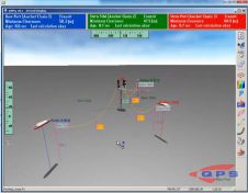
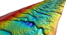
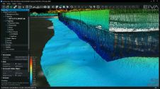
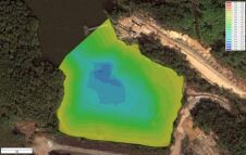
Found 75 results
Sort by

QINSy Adds Advanced Catenary Options

The recent release of QPS QINSy (8.10.2013.10.10.1) includes real-time functionality for using advanced catenary tools to compute the tow cables and anchor chains involved in a rig move using a...

Read more

EMODnet Bathymetry New Release

A new version of the EMODnet Digital Bathymetry (DTM) has recently been published which now covers all of Europe's seas. The resolution of the EMODnet DTM has been increased from...

Read more

New NaviModel Software Generation

NaviModel 4 by EIVA, Denmark, includes a free viewer, the completion of laser scanner data implementation throughout the data acquisition and processing workflow covered by the EIVA NaviSuite products, and...

Read more

Mapping Liquid Water on Mars

To tie in with NASA’s recent announcement about the discovery of liquid water on Mars, Esri has put together an interactive story map showing the craters and canyons on Mars that...

Read more